
This week, there’s not much going on weather-wise across most of the country, though a few regions will see some unsettled conditions. The overall pattern remains fairly typical for early November, with cooler air spreading across the northern states and lingering mild weather hanging on in the South.
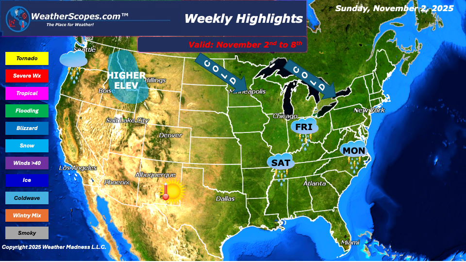
Showers and thunderstorms will move through the Mid-Atlantic states late Sunday night into Monday. Nothing too severe is expected, but a few pockets of heavier rain could briefly develop before conditions dry out by midweek. Meanwhile, the Pacific Northwest will see more showers again this week as several Pacific systems continue to bring periods of rain and mountain snow, a trend that has been persistent lately.
In the Northern Rockies, snow is expected in the higher elevations throughout the week as colder air filters in. A cold front will also make its way into the Upper Great Lakes and Northeast in several waves, reinforcing chilly air and bringing occasional showers. By the end of the week, parts of the northern Plains into the Upper Great Lakes could even see some flurries as temperatures drop further.
Farther south, showers will develop across the Ohio Valley on Saturday, out ahead of another approaching cold front. Otherwise, much of the central and southern U.S. will stay fairly quiet and seasonable. As for the tropics, it looks like the tropical season could be winding down for good—nothing on the maps suggests any new development, and no tropical activity is expected in the near future.
By Matt K.
Meteorologist-In-Training

Leave a comment