

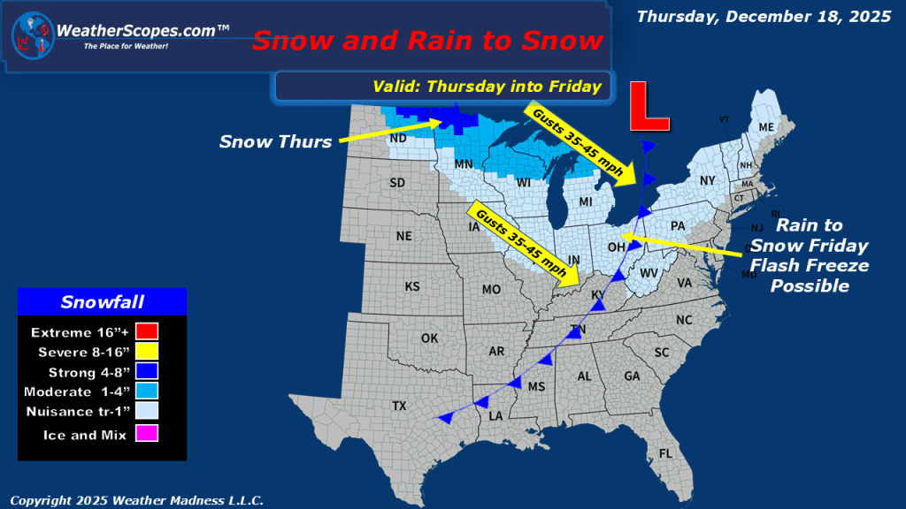
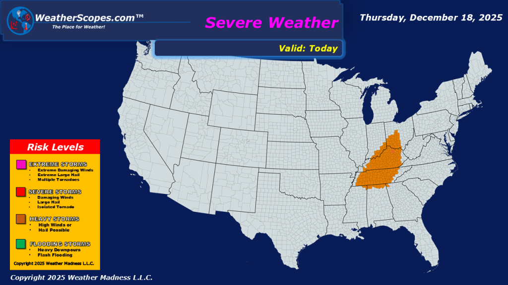
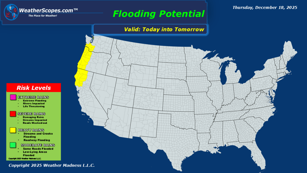
This morning, we are already seeing our next system come through the Northern Plains into the Upper Great Lakes, and Midwest. Showers and thunderstorms out ahead of a cold front that will bring the cold and gusty conditions back to the Plains and Great Lakes. We could see some severe weather develop today in the Tennessee Valley. Areas further north will see snow where accumulations look to be around 1-4”, the heaviest totals will be along the North Dakota / Minnesota border. The threat will be will all the rain and then cold air coming behind this system we could see a flash freeze in the overnight hours into tomorrow, creating some icy and dangerous conditions. As this system moves into the Northeast tomorrow the same threat exists with the rain and cold air behind it, creating a flash freeze for the Northeast on Friday. The Pacific NW and Northern California still dealing with showers and thunderstorms, as they move through the area creating the potential for some localized flooding.


Leave a comment