
This week the weather will remain active across several regions of the country. The Pacific Northwest and Northern California are expected to see additional rounds of showers and thunderstorms, maintaining an elevated risk for flooding in these areas. Residents should continue to monitor local conditions, especially where heavy rainfall has already occurred. By mid-week, Southern California may also experience periods of showers and isolated thunderstorms as unsettled weather moves through the region.
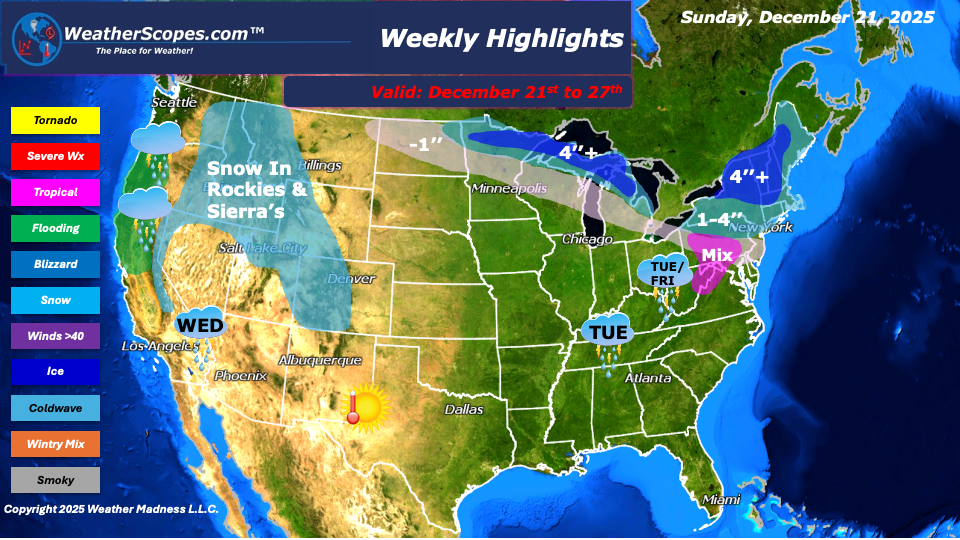
Snow will impact higher elevations in the Rockies and the Sierra Nevada, where areas could receive several inches of snow this week. Farther east, snow is expected at times across the Northern Plains, Upper Great Lakes, and the Northeast. The first snow system is forecast to move through from Monday into Tuesday, followed by another system Friday into Saturday. Most locations will see accumulations of 1-4’’, while parts of Michigan’s Upper Peninsula and areas near Lake Erie and Lake Ontario could exceed 4’’+ for the week. Lake-effect snow will also impact the Northeast this week. Areas along the Appalachians and Southern PA, will see some mixed precipitation with these snow systems coming through. Locations further south of the heaviest snow this week, from the Northern Plains to Northeast, could see a coating of snow.
Rainfall will be more common from the Northeast through the Tennessee Valley, with colder air keeping the bulk of the snow farther north. Temperatures will start the week on the colder side across the Plains, Midwest, and Northeast. As the week progresses, a moderating trend is possible, and some areas could experience milder conditions around the holiday, with temperatures reaching into the 40s and 50s. Happy Holidays!
By Matt K.
Meteorologist In-Training

Leave a comment