
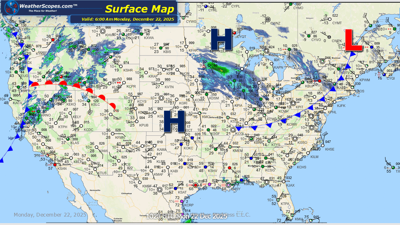
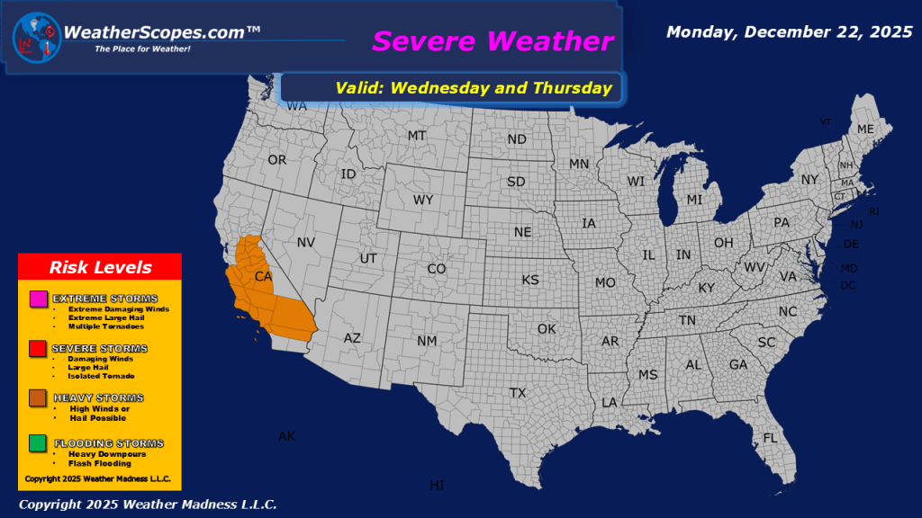
This morning, we are already seeing some snow showers across the Upper Great Lakes as this system will continue to make its way across The Great Lakes and into the Northeast today and into tomorrow. Accumulations look to be around 1” and totals will be greater in the Northeast over the next 24-48 hours, with most areas seeing 1-4”. Upstate NY and interior portions of the Northeast could see more than 4” of snow when this system moves out of the area by Wednesday. California and the Pac NW still seeing showers this morning and that will continue throughout the day. Much of California is dealing with the daily threat for localized flooding. Looking ahead on Wednesday for Southern California, some severe weather is possible to come through the area. The eastern portion of the US could see some milder temps this week, just in time for the holidays. The warmth will stay to the south and Southeast, but the Plains, Midwest, and parts of the Northeast could see temperatures in the 40’s to 50’s for Christmas.


Leave a comment