
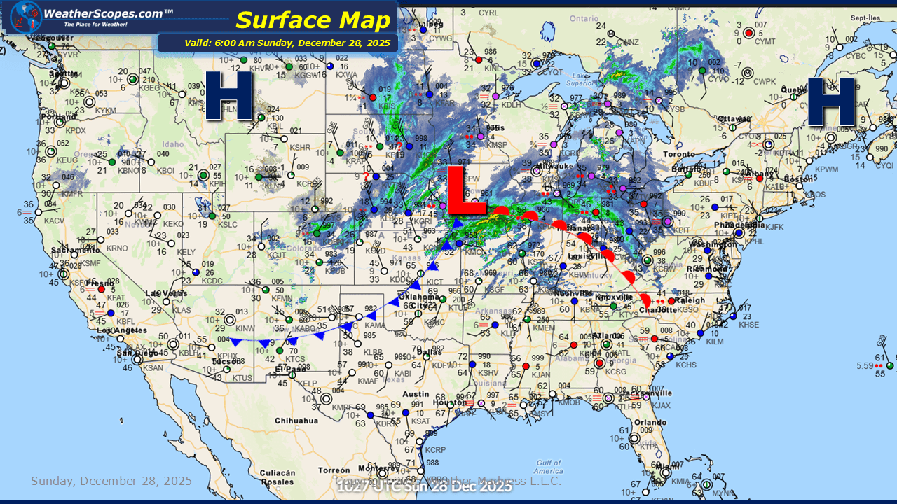
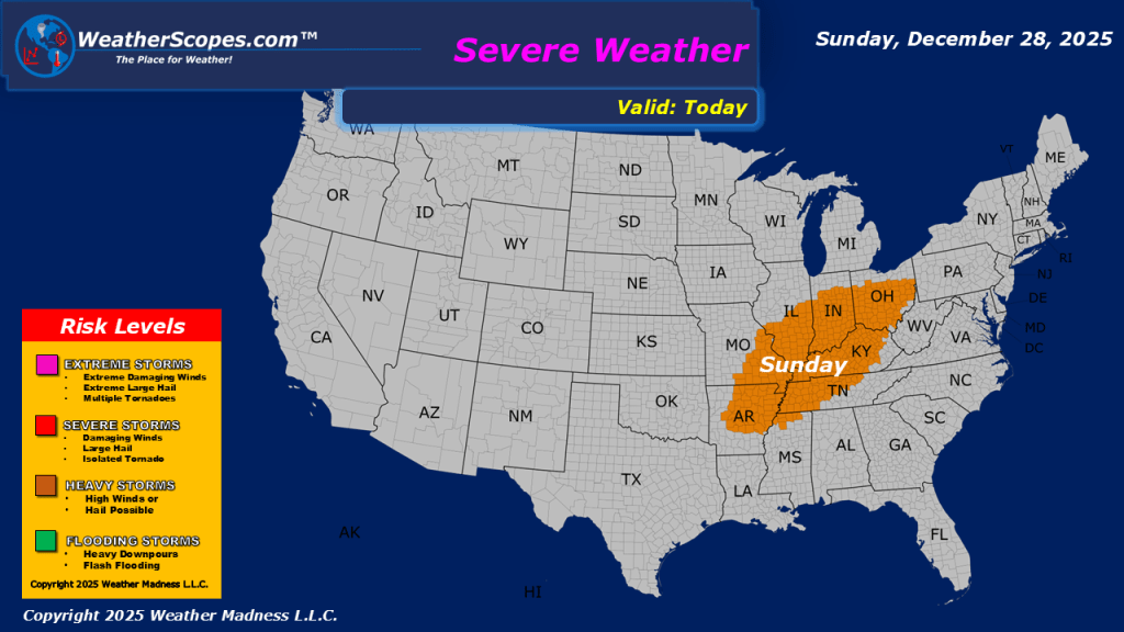
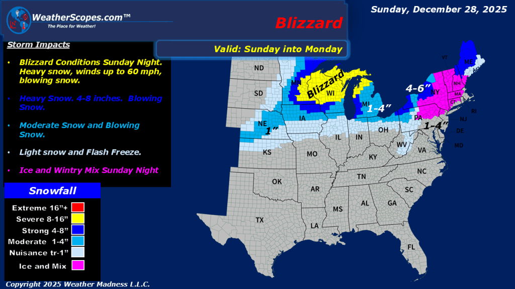
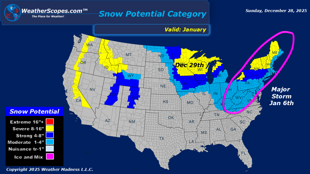
This morning, we are already seeing showers and thunderstorms move through the Midwest. Later today there is a threat for some gusty storms across Southern Illinois into the Ohio and Tennessee Valley’s. Behind this system we are seeing snow out across the Plains. Later tonight and into tomorrow the rain will turn into snow for much of the Great Lakes, Midwest, and into the Northeast. From Central to Northern Wisconsin and the UP of Michigan could see blizzard like conditions with heavy snow, and some gusty winds of 40-50mph. Accumulations look to be around 1-4”, and from Central to Northern WI seeing over 8”. A wintry mix will move into the Northeast later tonight and into tomorrow, causing some dangerous conditions to start the work week. Behind this system the cold returns and could cause a flash freeze with the rain and snow combo. Some areas in the Midwest could see a 20–30-degree temperature difference from Sunday’s high temps to Mondays.

Leave a comment