
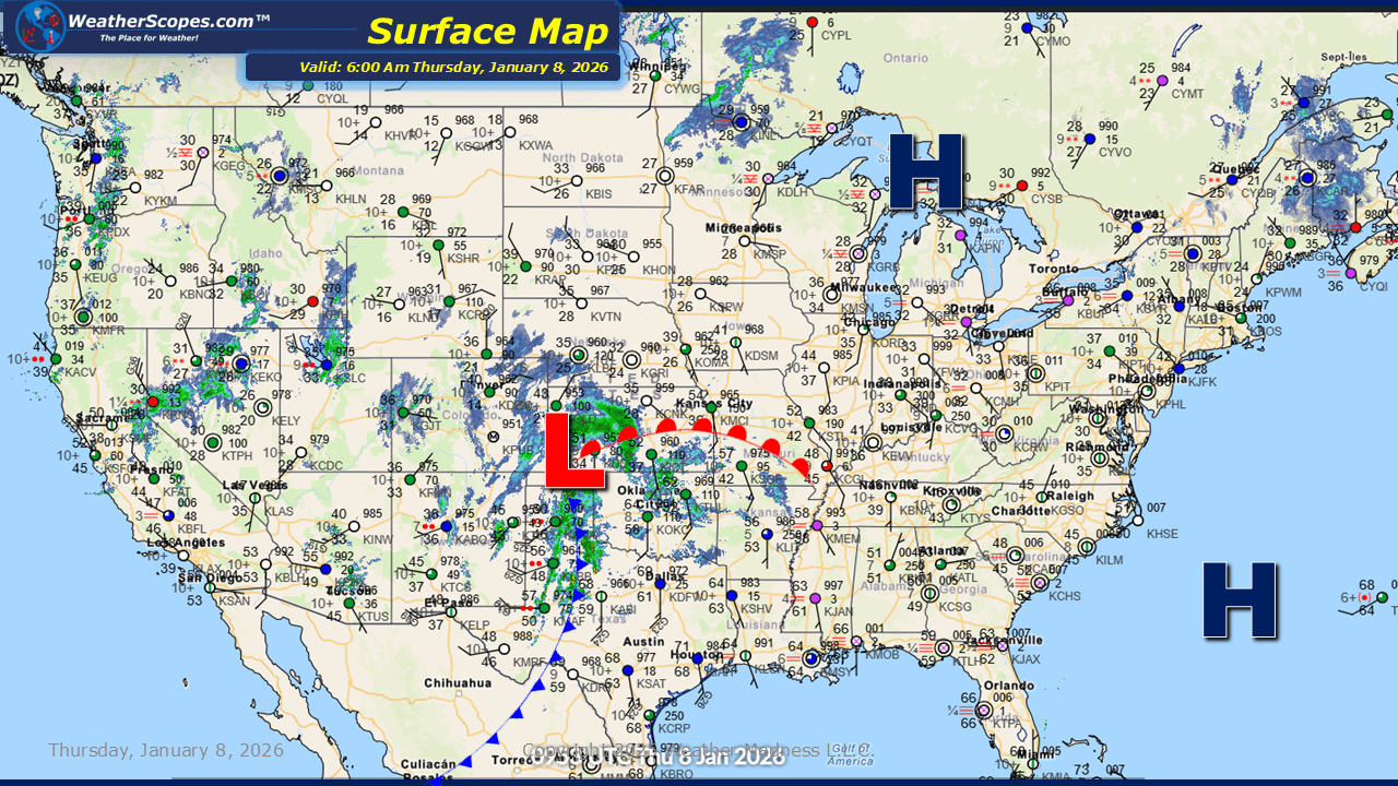
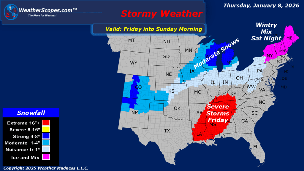
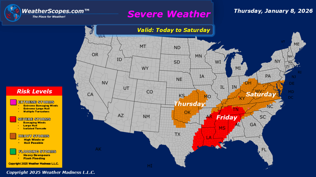
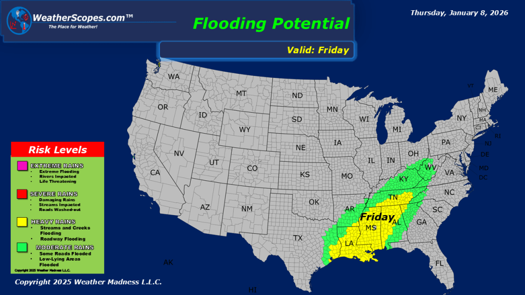
This morning, we are already seeing showers and thunderstorms move across the Plains into Oklahoma and Texas. This system will move through the Midwest and Great Lakes throughout the day. Some severe weather is possible with this system as gusty storms and heavy downpours could become an issue. A tornado can’t be ruled out with this system across parts of eastern Oklahoma, but Friday looks to be a day we could see a few tornadoes. On the back end of this system parts of Nebraska, Iowa, Minnesota, Wisconsin and the UP of Michigan will see snow. Accumulations look to be on the low end with a coating to 2”, with areas in Central Wisconsin around the Wausau area seeing the most with 3-5”. More showers and thunderstorms out in the Four Corners states, and snow in the higher elevations of The Rockies. The next few days look to be pretty active with more storms in the south and cold weather returning to the Great Lakes, Midwest, and Northeast.

Leave a comment