
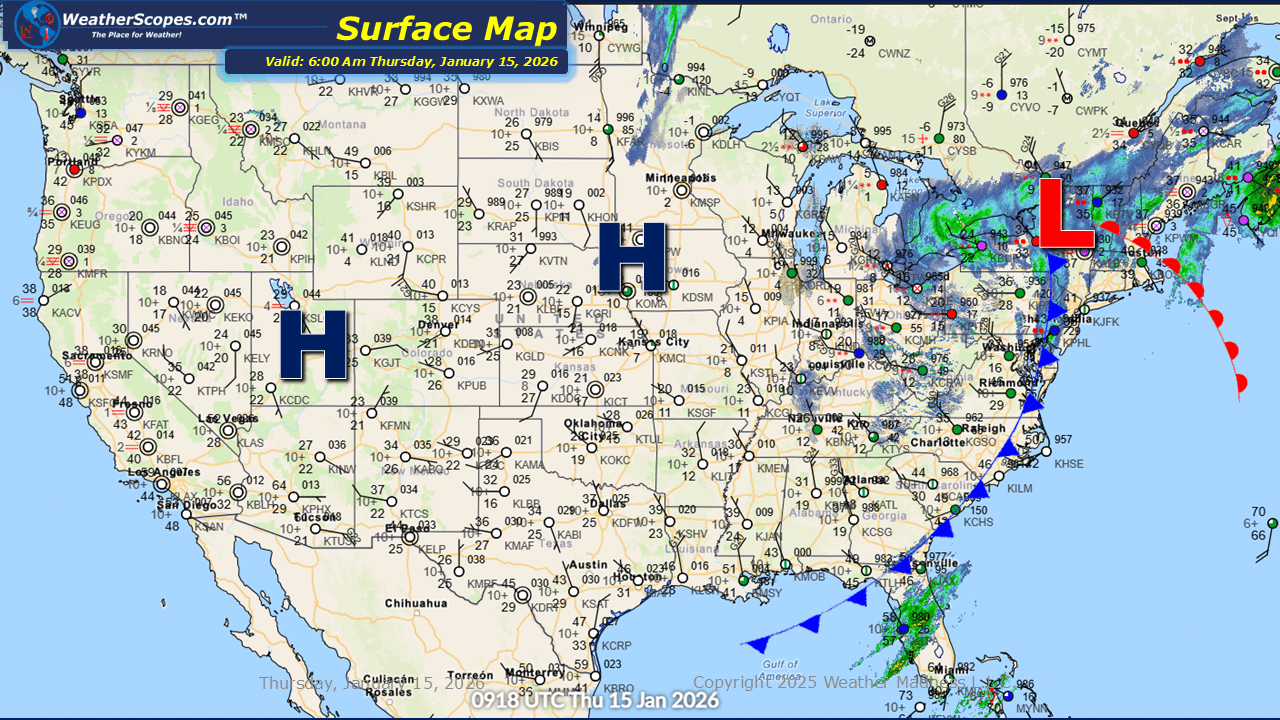
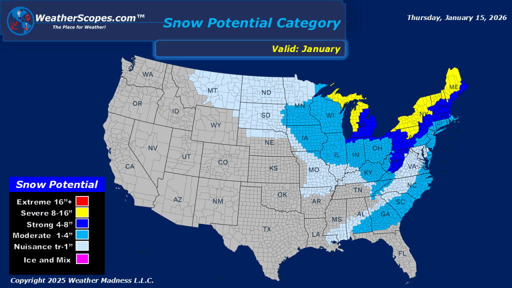
This morning, we are seeing snow come through the Great Lakes, Northeast, and into the Appalachians. This system will continue to make its way to the east throughout the day. Accumulations look to be a coating to 4”, with areas further interior in the Northeast seeing 4”+. Later tonight another system will come through the Upper Great Lakes into the Midwest and Northeast tomorrow. That system will bring a coating to 4” to the area with the highest snow totals in Northern Wisconsin, Northern Minnesota and the UP of Michigan. The southeast into parts of Florida will see some showers and a possible thunderstorm throughout the day. The cold has made its way down South! After a cold front came through the Southeast this morning they are waking up to some colder temps in the 20s and 30s.


Leave a comment