
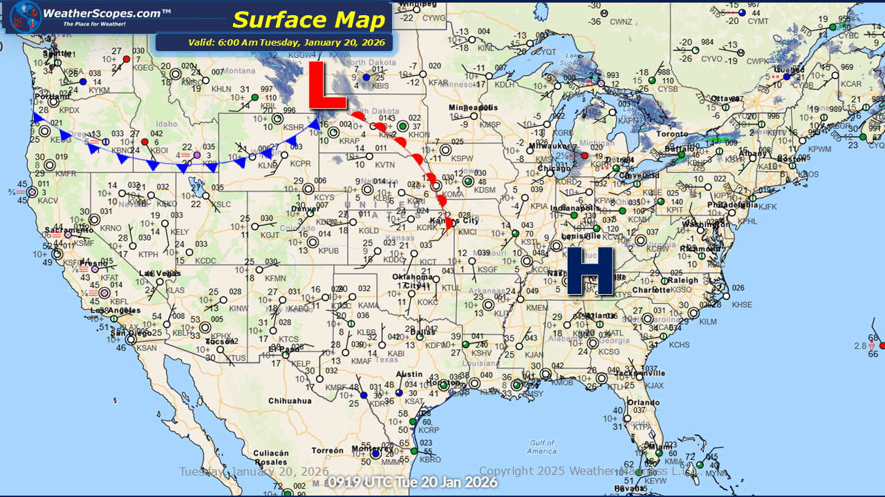
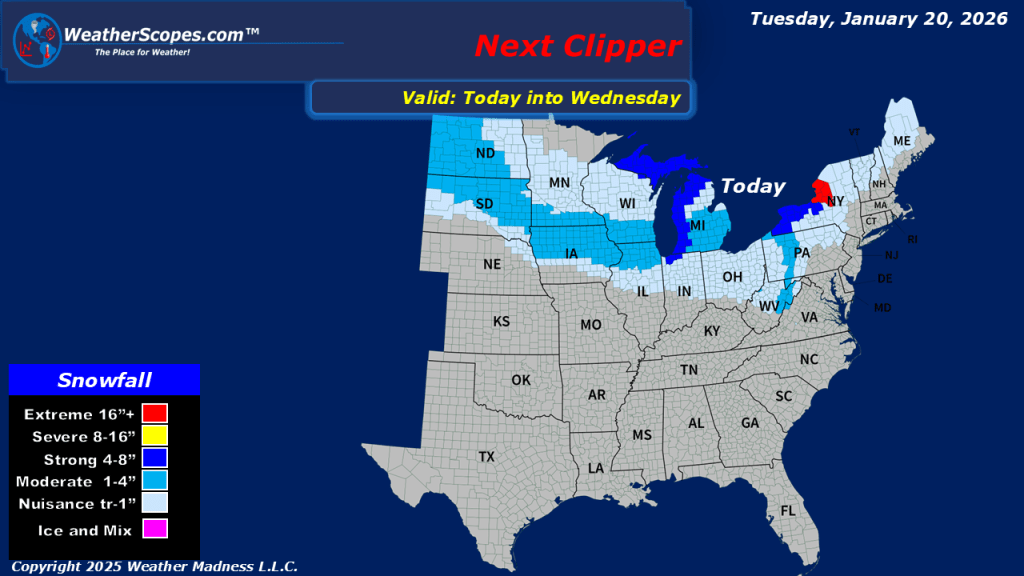
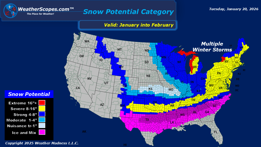
This morning, we are seeing some lake-effect snows in the Great Lakes and Northeast. Another clipper will come through the Northern Plains into the Great Lakes later today and into tomorrow. Accumulations look to be around a coating to 4”. The UP and Western Michigan will see heavier accumulations, as well as the Buffalo and Watertown NY area. The cold still impacting much of the eastern portion of the US with single digit temperatures in a lot of area this morning, and some below zero temperatures in the Upper Great Lakes. Looking ahead there is potential for the south to see a mixed precipitation storm come through this weekend bringing ice and dangerous conditions to the area.


Leave a comment