
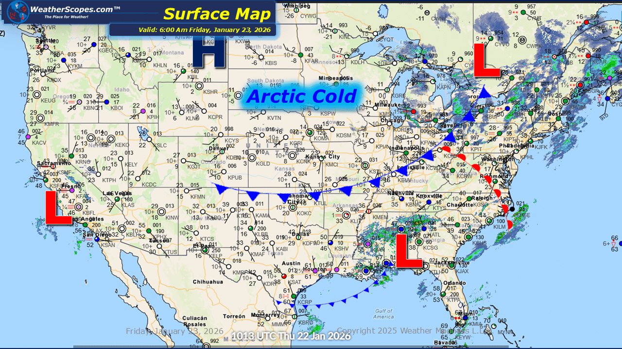
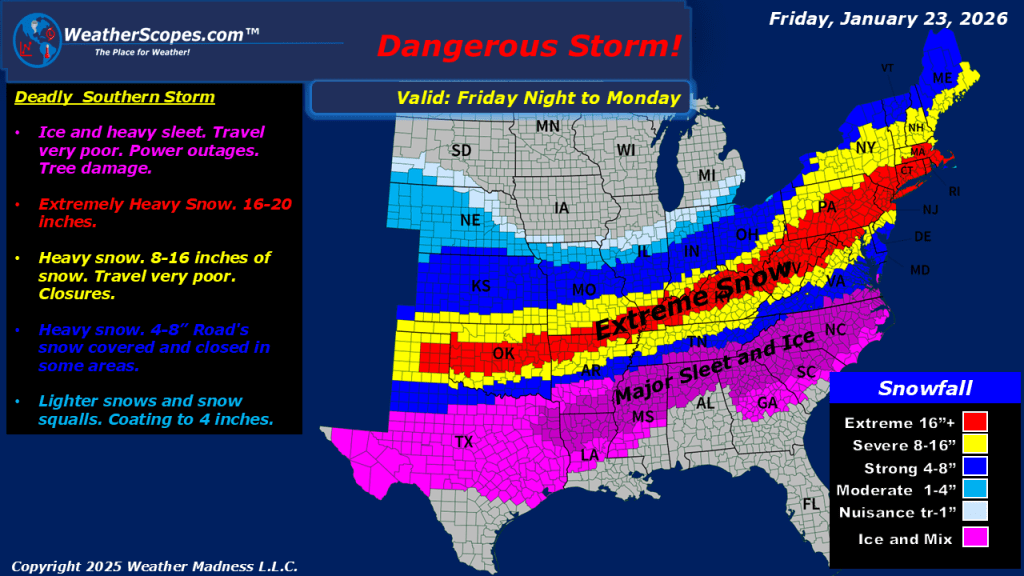
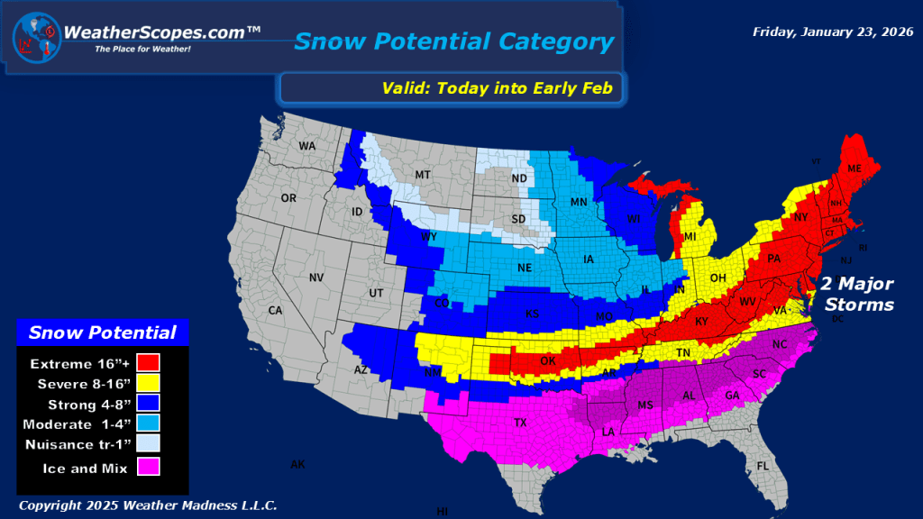
This morning, we are seeing some very cold weather out across the Plains into the Great Lakes. Temperatures right now are well below zero in most areas and won’t get much warmer today. With the cold, some lake-effect snows will impact the Great Lakes and parts of the Northeast today. Accumulations look to be around 1-4” with the UP and Western portion of Michigan seeing over 4”. The Watertown/Syracuse area could also see 4”+ from the lake-effect snows today. Looking ahead to this weekend, we will see a major and dangerous storm impact the southern portion of the US. Bringing some heavy snows and ice to the area. From Oklahoma through the Tennessee and Ohio Valley and into parts of the Northeast could see over 16” of snow. Area’s south of the snow will see some dangerous sleet and ice causing dangerous driving conditions and power outages.

Leave a comment