
This week cleaning up after Fern is the big stort. Fern dropped some heavy snowfall totals stretching from Oklahoma through the Northeast. Crews will deal with digging out and restoring power to many areas in the South that lost power due to the ice storm.
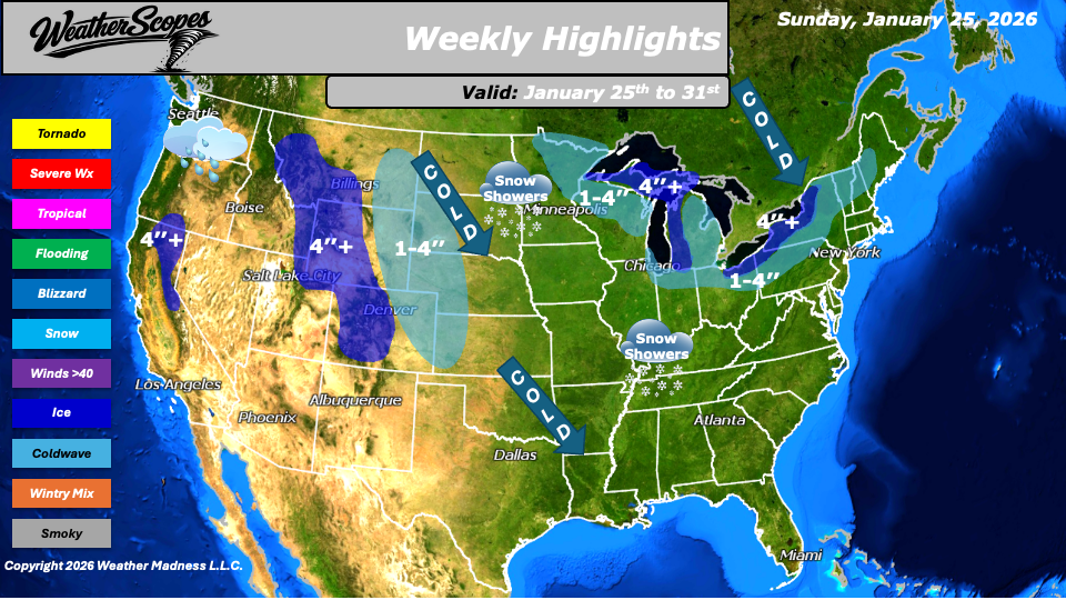
Across the Great Lakes, lake-effect snow remains active and will add to snowfall totals through the week, especially in areas that have already been hit hard. A couple of fast-moving clippers will bring additional winter weather. One moves through the Great Lakes into the Northeast Monday night into Tuesday, bringing periods of snow and areas of blowing snow. Another arrives Thursday night into Friday across the Northern Plains with more snow.
Out West, snow continues in the Northern Rockies and the Sierras this week, keeping mountain travel challenging at times. The Pacific Northwest stays active with rain on multiple days, maintaining a wet pattern to wrap up the week. Snow showers are expected to spread across the Midwest into the Tennessee Valley on Thursday, generally lighter but still capable of creating slick travel conditions.
Cold air remains firmly in place across much of the central and eastern United States. Even the South and Southeast will continue to see cold temperatures throughout the week. We could also see another snowstorm come through the area to end the month and begin February.
By Matt K.
Forecaster

Leave a comment