
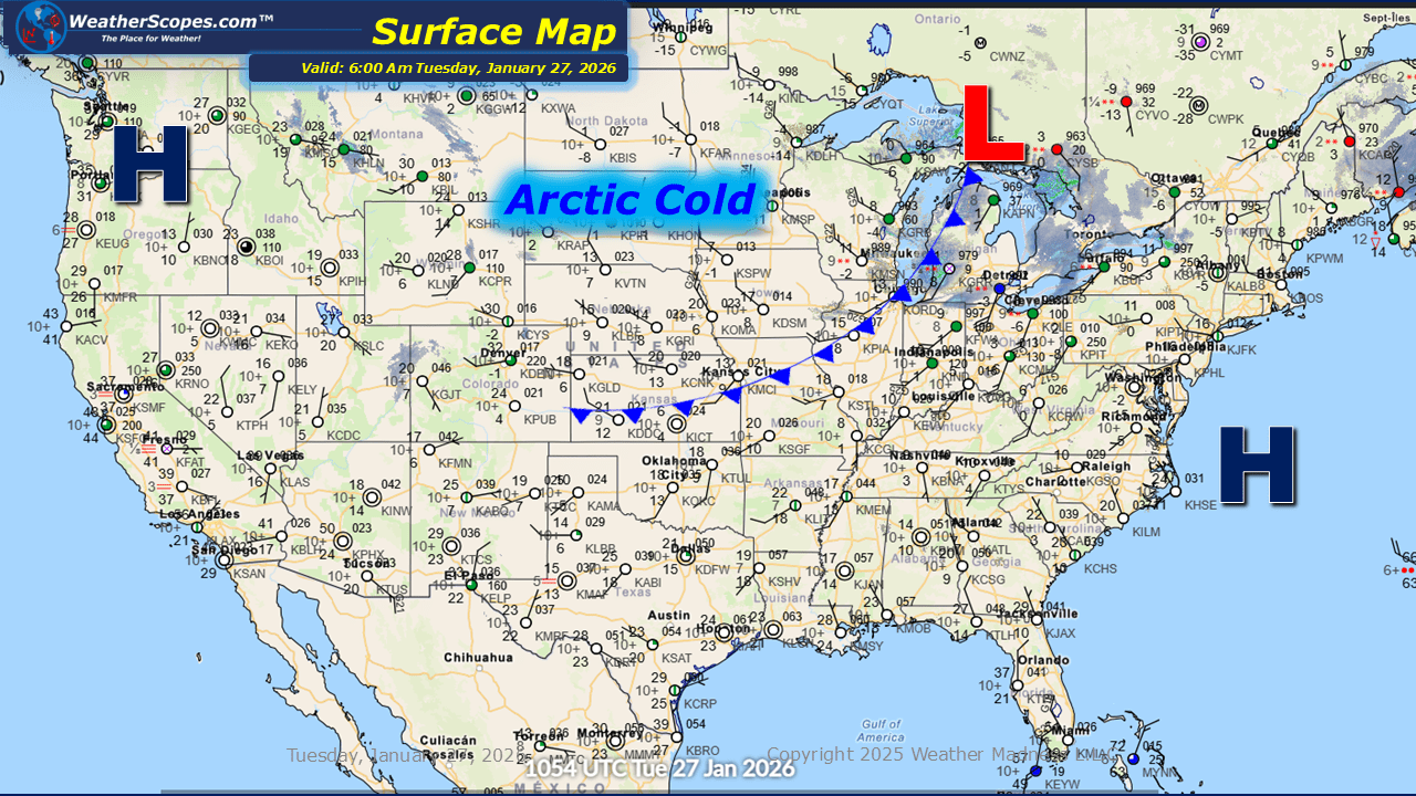
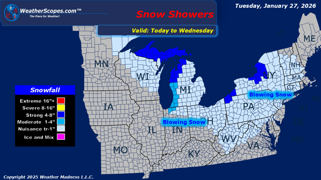
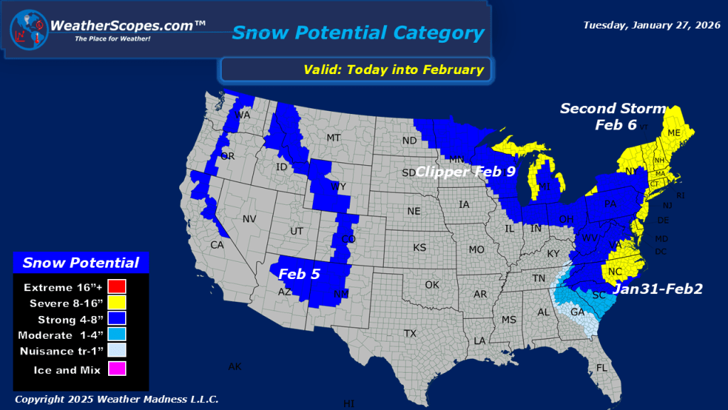
This morning, we are already seeing some lake-effect snow showers across the Great Lakes with some blowing snow making conditions blustery. The snow will last into Wednesday with areas seeing accumulations of a coating to 4”+ the closer you are to the Lakes. Arctic cold weather still impacting the Plains into the Great Lakes and Northeast with temperatures this morning in the single digits and below zero. Single digit temps are making their way down into the South with areas in Tennessee and North Carolina seeing some very cold weather this morning. In the Pac NW we will see some showers come into the area later tonight and into tomorrow, as well as some snow showers in the Northern Rockies and Sierras. Still watching our next system this weekend which will impact the Mid-Atlantic into the Northeast with more snow.

Leave a comment