
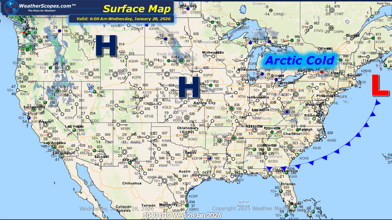
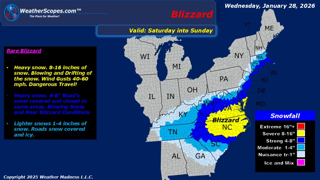
This morning, a clipper system is moving through the Great Lakes into the Northeast, bringing continued lake-effect snow to the region. Snow accumulations are expected to be light for most areas, generally a coating, while portions of the Upper Peninsula and western Michigan could receive more than 3 inches. The Buffalo and Syracuse areas may also see snowfall totals exceeding 3 inches. In addition, isolated snow showers are occurring across parts of the Plains and West Virginia. Arctic cold continues to impact the Plains, Great Lakes, and Northeast, with temperatures in the single digits and, in some locations, well below zero. This cold air remains in place across the South and will help set the stage for the next storm system expected this weekend. The Mid-Atlantic and Northeast could see another round of snowfall, with the heaviest totals likely from North Carolina into Virginia. Some areas in this region may experience blizzard-like conditions. Areas to the south and west look to receive 1-4 inches of snow, while the heaviest bands in North Carolina and Virginia could produce totals exceeding 8 inches. The Northeast coast will also see some heavier snow with accumulations of 4”+.

Leave a comment