
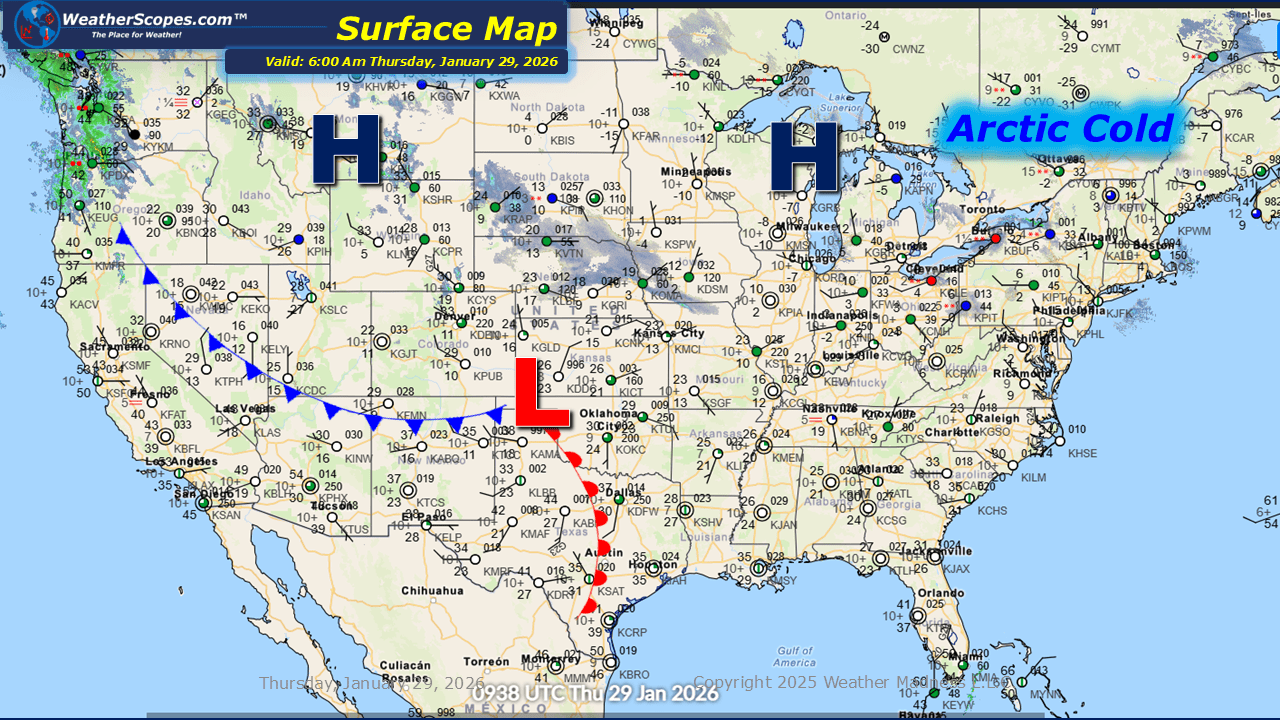
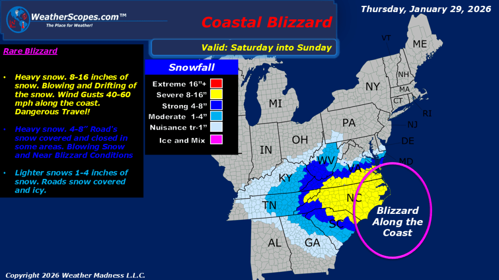
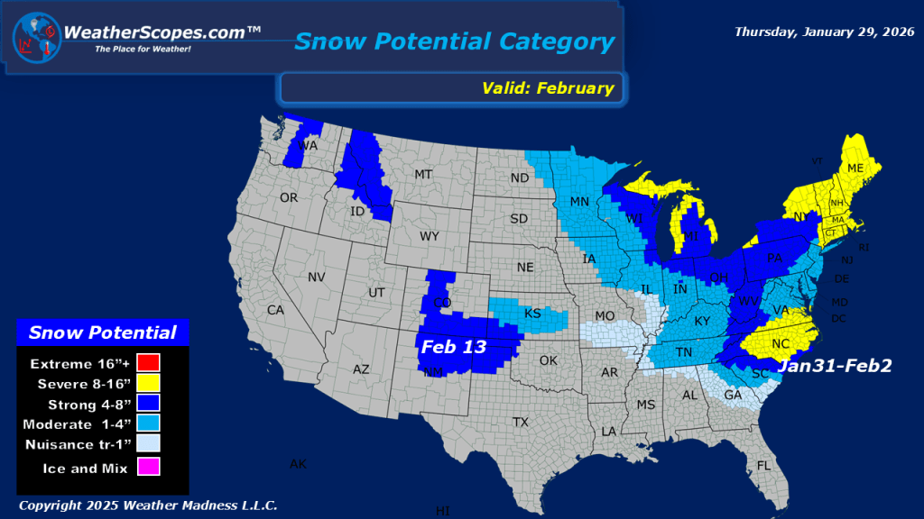
This morning, a clipper system is moving through the Plains, producing a light coating of snow. Lake-effect snow continues to impact the Great Lakes region today, with accumulations of 4 inches or more in areas closest to the lakes. Arctic cold remains entrenched across the Plains, Great Lakes, and Northeast, with temperatures well below zero this morning in the Upper Great Lakes. We continue to monitor the potential for a blizzard this weekend across portions of the Carolinas and Virginia. Gusty coastal conditions could create hazardous conditions. Parts of South Carolina, into North Carolina and Virginia could see over 8” of snow. As this system moves up the coast, parts of New England, including Maine, could see some snowfall, though amounts currently appear lower than initially anticipated. The Cape Cod area does have the potential for more significant accumulations. There is still some uncertainty as the system could track farther offshore, resulting in little to no snow for New England. We will continue to monitor the evolution of this storm over the next several days.

Leave a comment