
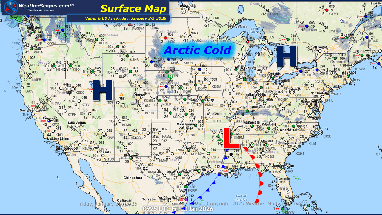
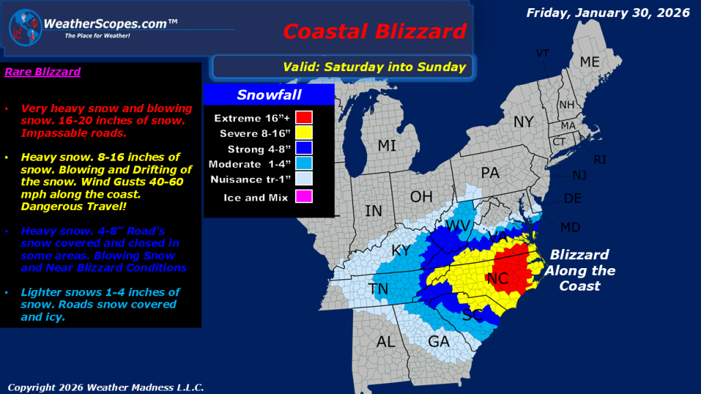
This morning, light snow is occurring across the Plains, with accumulations ranging from a light coating up to 1 inch. Lake-effect snow will once again impact the Great Lakes region today, with the heaviest accumulations expected in the Upper Peninsula of Michigan, the Buffalo area, and southeastern Wisconsin into the Chicago metro area. Most locations in these regions can expect snowfall totals of 1 to 4 inches. Cold air continues to affect the Plains, Great Lakes, and Northeast, with temperatures in the single digits and some areas experiencing well below zero readings. The Tennessee Valley may see light snow showers later today. A significant winter storm is expected to bring blizzard conditions to the Carolinas and Virginia tomorrow. Some areas could receive over a foot of snow, and strong, gusty winds will make travel extremely dangerous. Areas farther north and west will see lighter snowfall amounts. Areas farther south, including the Atlanta metro area, could also see a light coating of snow. As the storm moves eastward, parts of Cape Cod could see snow as the system exits into the Atlantic.

Leave a comment