
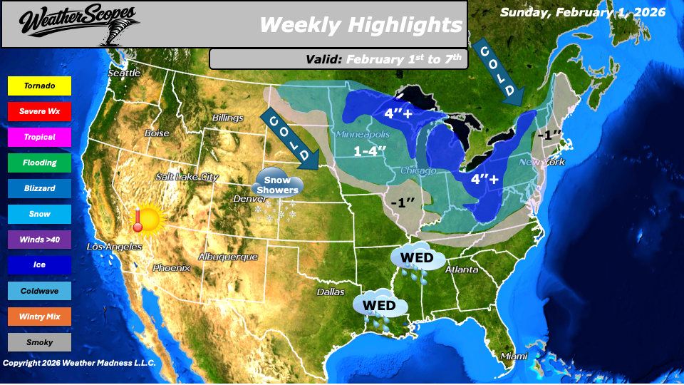
This week’s weather pattern will be active across much of the northern and eastern United States, driven by a series of fast-moving clipper systems. The first clipper will move through the Plains on Sunday before tracking across the Great Lakes and into the Northeast by Monday, bringing periods of light snow and reinforcing colder air.
Another clipper is expected midweek, impacting the Ohio and Tennessee Valleys on Wednesday. To the south of this clipper, milder air will allow for rain to develop across parts of the Southeast as the system moves through the region. Also, on Tuesday into Wednesday snow showers across portions of the Central Plains and into the Rockies, with generaly light accumulations.
A third clipper is forecast to arrive late Friday night into Saturday, once again affecting the Great Lakes and Northeast and continuing the unsettled winter pattern. Snowfall totals through the week are expected to average between one and four inches across much of the Plains, Great Lakes, and Northeast, with some areas seeing only a coating to around one inch on the southern and western edges of the systems. Higher snowfall totals exceeding four inches are possible in parts of the northern Great Lakes, the Ohio Valley into the Appalachians, and interior sections of the Northeast where multiple systems overlap. Cold air will persist across the Plains, Great Lakes, and Northeast throughout the week, maintaining winterlike conditions. Next weekend some dangerous cold will impact the Northeast, bringing temps well below zero into areas like NYC. In contrast, the South is expected to see a break from the colder temperatures with milder air returning later in the week, while the West remains mild and dry.
By Matt K.
Forecaster

Leave a comment