
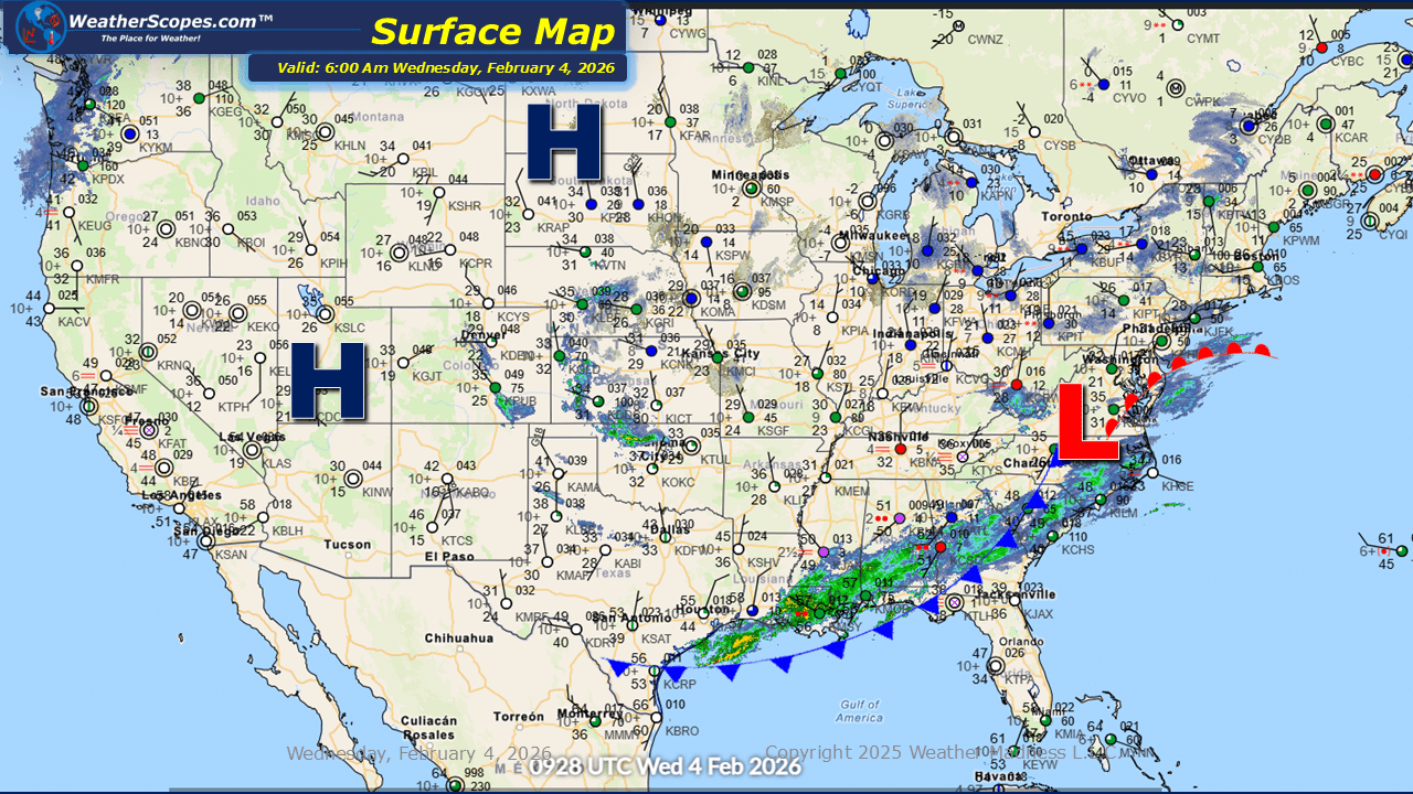
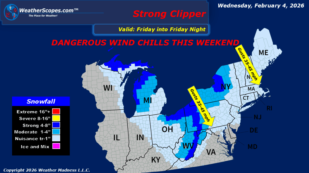
This morning, scattered showers are developing ahead of a cold front across the Southeast, bringing cooler conditions to the region by Thursday. Light snow showers are expected in the Great Lakes and Northeast, with minor accumulations possible, generally a light coating. Later tonight, rain will transition to snow extending from eastern Tennessee/Kentucky, into North Carolina, and the Virginias. Snow accumulations in these areas are expected to range from a coating to around 2 inches. Looking ahead to Thursday and Friday, a clipper system will move through the Great Lakes on Thursday and again on Friday, producing snowfall totals of approximately 1 to 3 inches. The Friday system is also expected to impact portions of the Northeast.

Leave a comment