
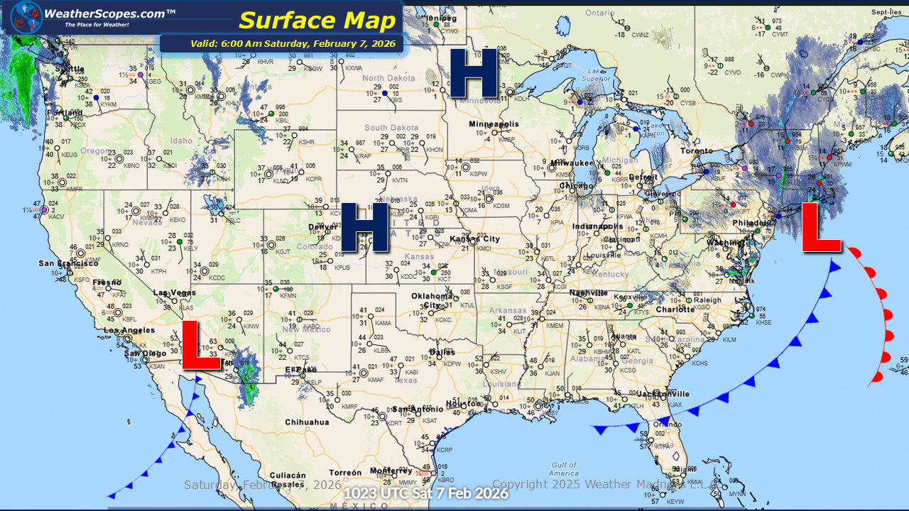
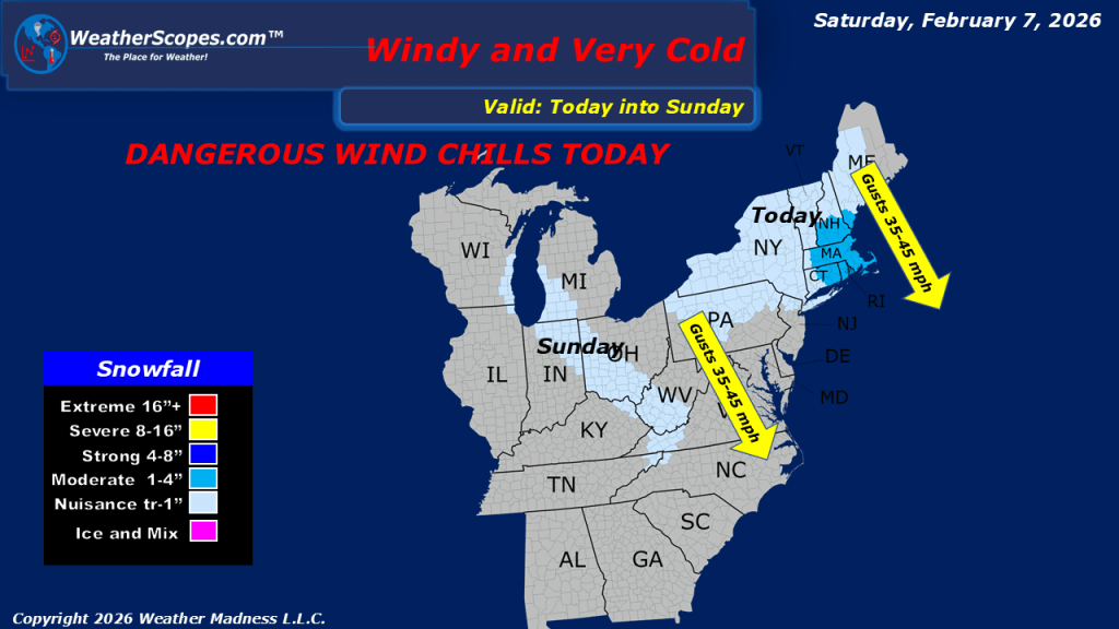
This morning, we are seeing snow across the New England area and portions of the Northeast, from a clipper coming down. Accumulations look to be a coating in most areas with 1-4” of snow in the New England area. Gusty conditions along with some arctic cold will impact the Northeast today, bringing some dangerous wind chills. Areas in the Northeast could see wind chills of -20 to -30 degrees below zero. Limit your time outside in these conditions, as frost bite can happen in minutes when exposed to these extreme conditions. Later tonight and into tomorrow morning, a clipper will come through the Great Lakes into the Ohio Valley. A narrow band of snow will impact the UP and Western Michigan, as well as, Indiana, and Western Ohio into West Virginia. Accumulations look to be light at a coating to 2” for most areas. Out in the Pacific NW, some showers will come through the area today and into tomorrow.

Leave a comment