
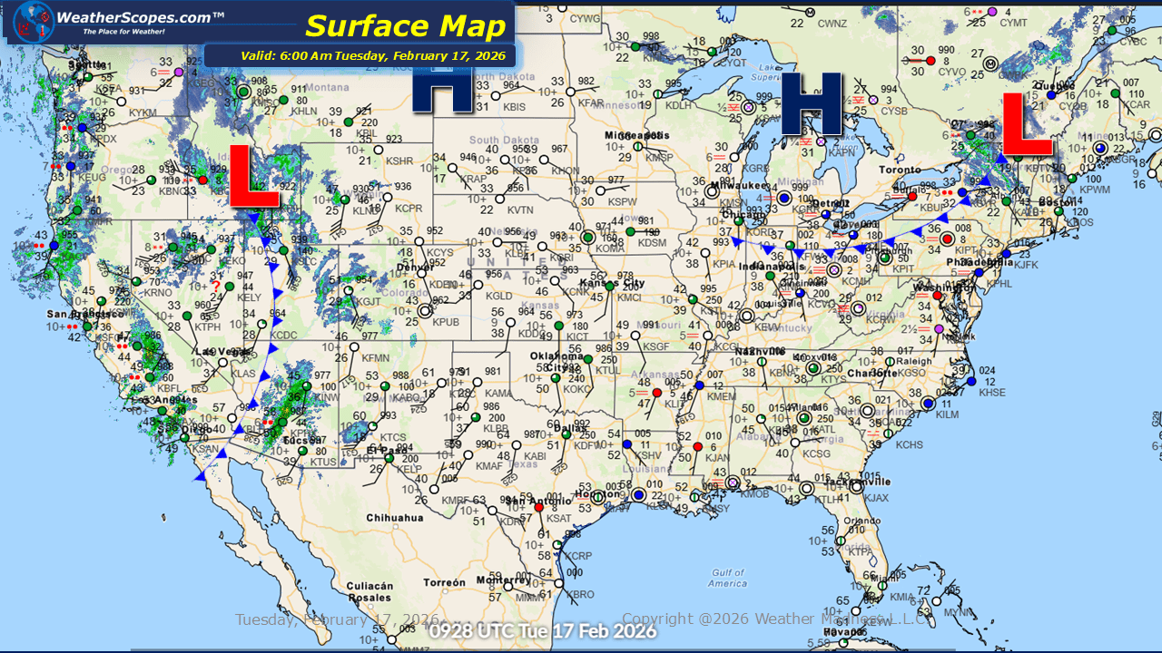
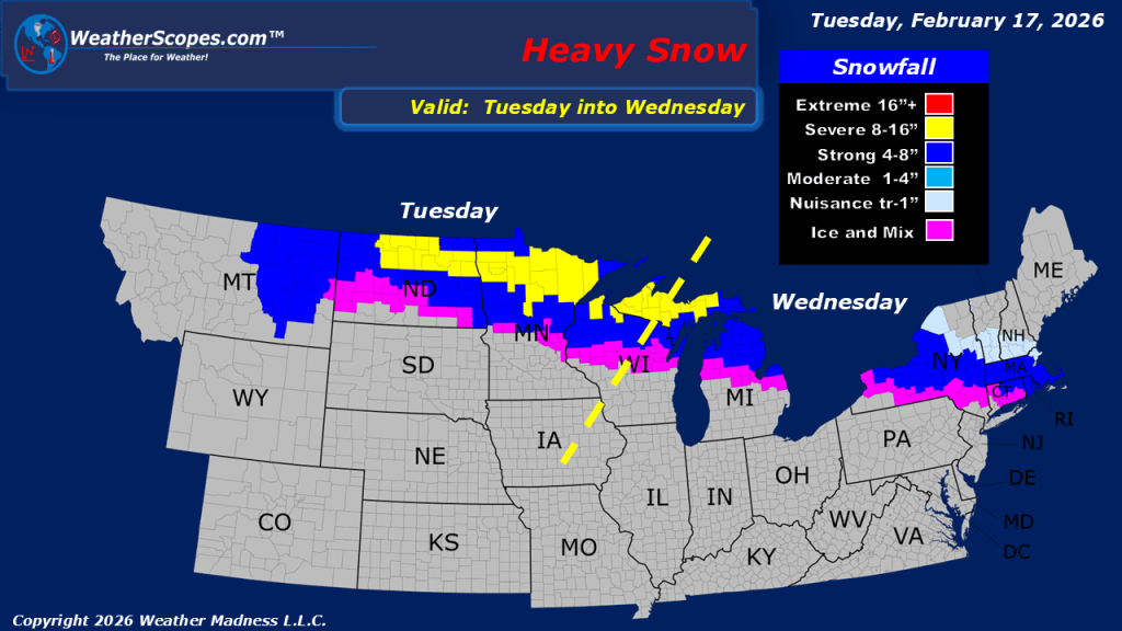
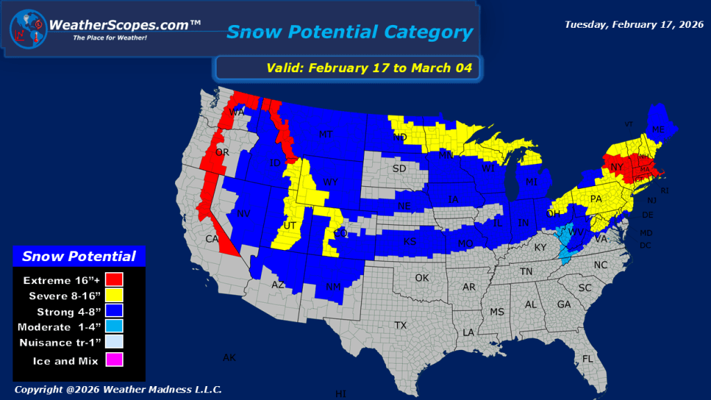
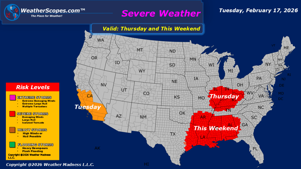
This morning, we are seeing showers continue across the Pacific Northwest, while portions of California are seeing steady rainfall that may lead to localized flooding concerns in vulnerable areas. In Southern California, gusty thunderstorms are expected to develop, bringing brief downpours and strong winds. As this system progresses inland, higher elevations will benefit from significant snowfall. The Sierra Nevada and the central and northern Rockies are forecast to receive accumulating snow throughout the week. This will provide much-needed fresh snowfall for regional ski resorts, improving snowpack conditions. Wind is also a major factor across parts of the Intermountain West. Portions of Wyoming, along with areas of Colorado and Montana, are experiencing very gusty conditions this morning, with wind gusts exceeding 60 mph in some locations. These strong winds may create hazardous travel conditions, particularly for high-profile vehicles, and could result in localized power disruptions. While much of the eastern US is enjoying milder weather today, with relatively calm conditions compared to the active pattern in the West. Later today attention then turns to the Northern Plains and the Upper Great Lakes, where the next weather system is set to move in. This system is expected to begin primarily as rain, but a transition zone of mixed precipitation and snow will develop farther north. As the system tracks eastward, it will bring a mix of rain and wintry weather to parts of the Northeast tomorrow, potentially leading to travel impacts in areas that see accumulating snow or icy conditions.

Leave a comment