
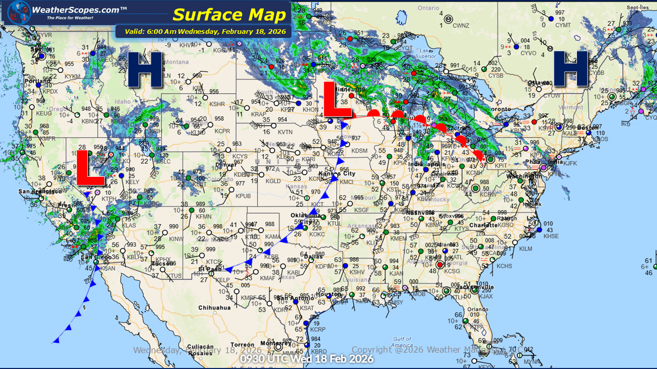
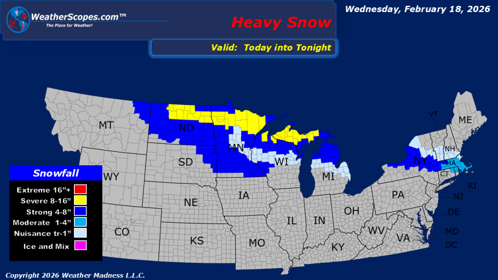
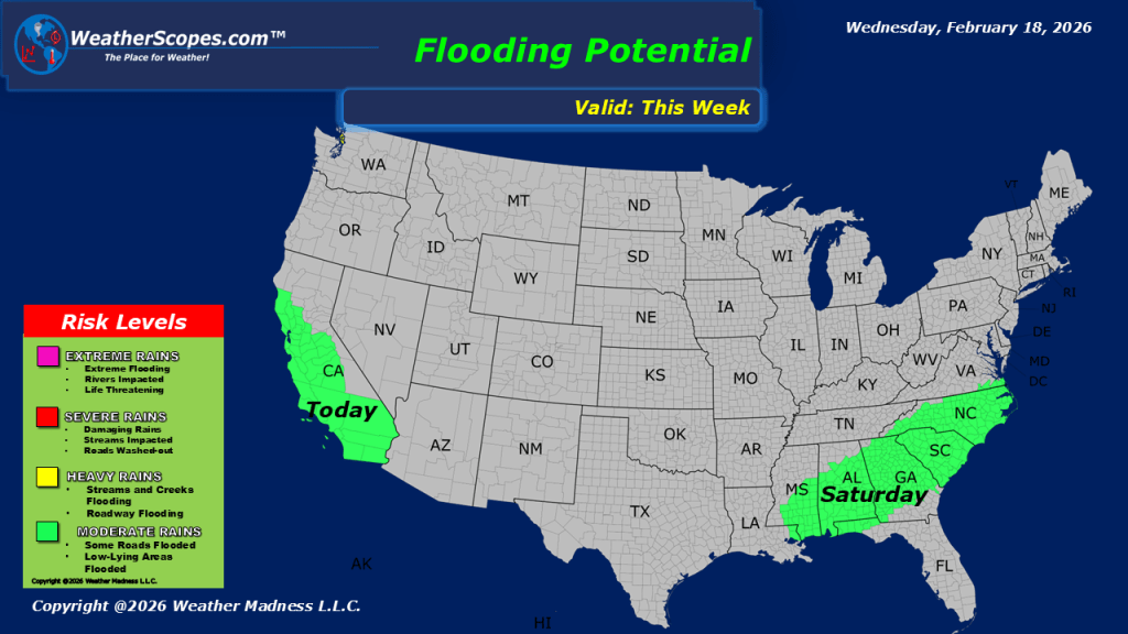
This morning, a dynamic weather pattern is unfolding across the United States as a strong storm system tracks from the Northern Plains into the Upper Great Lakes. This system is producing a wide range of precipitation types, with snow falling on the colder northern side, mixed precipitation in transition zones, and steady rain across areas farther south. Gusty winds are also accompanying the system, creating reduced visibility in areas of heavier snow and adding to travel concerns. As the storm continues its eastward progression, it is expected to reach parts of the Northeast later tonight, bringing additional precipitation. The western United States remains unsettled. An active weather pattern continues to impact California, where periods of heavy rain and gusty thunderstorms are expected throughout the day. With saturated ground in some locations, there is an elevated risk for localized flooding, particularly in low-lying and poor-drainage areas. Residents are encouraged to stay alert to changing conditions. In the higher elevations of the Sierra Nevada and the Rockies, snow and strong winds are combining to create blustery and occasionally hazardous mountain conditions. Reduced visibility, drifting snow, and difficult travel are likely in exposed areas and over mountain passes. Across the eastern portion of the country, milder air remains in place for now, providing a brief break from winter’s chill. However, this moderation is temporary. A return to colder temperatures is expected this weekend across much of the East, signaling a shift back toward more seasonable winter conditions.

Leave a comment