
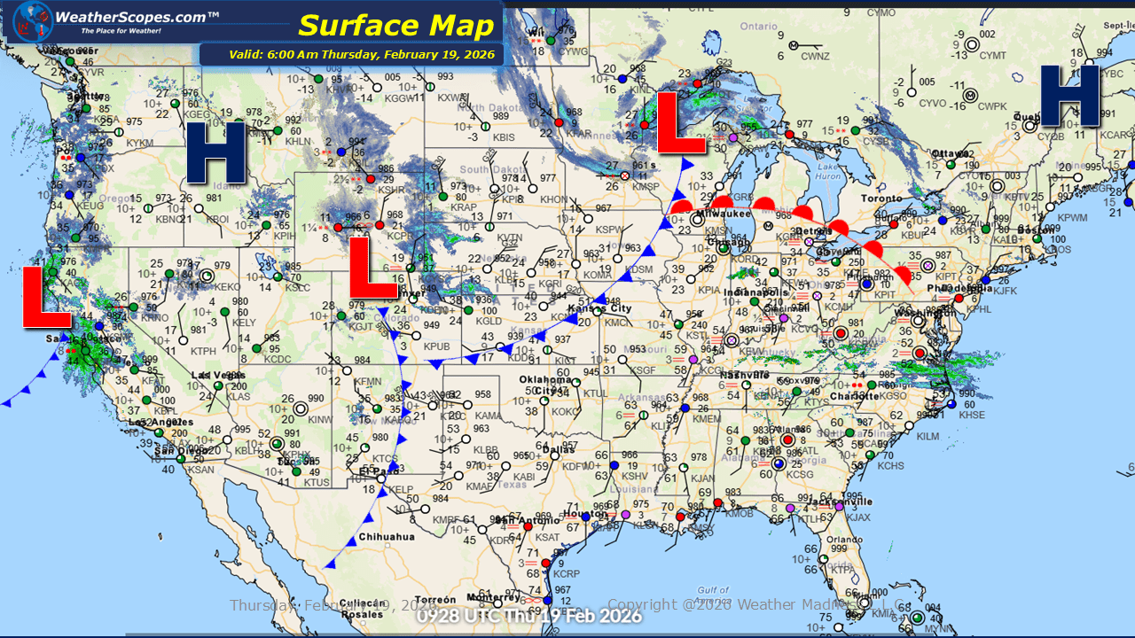
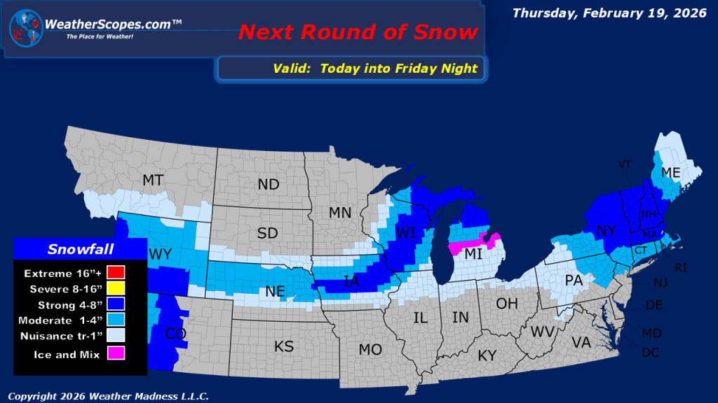
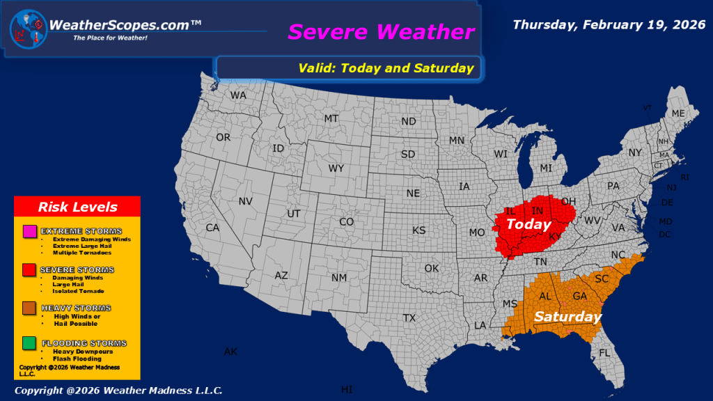
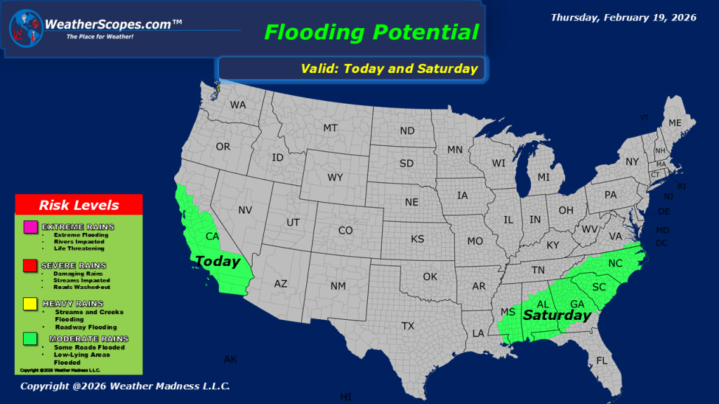
This morning, we are seeing some rain showers in the Midwest and into the Mid-Atlantic States. Out West, California continues to contend with ongoing rain and flooding concerns, with additional snowfall expected in the higher elevations of the Sierra Nevada and The Rockies, adding to an already substantial seasonal snowpack. Later today attention turns to the Ohio Valley, where atmospheric conditions appear increasingly favorable for severe weather to develop. With dew points rising into the 60s, the environment will support the potential for heavy rainfall, damaging wind gusts, hail, and even an isolated tornado. The contrast across the region will be especially notable as colder air surges in behind the storm, changing precipitation over to snow across parts of the Plains, Midwest, and into the Great Lakes. Accumulations look to be a coating to over 4” in certain spots in Iowa, Wisconsin, and Michigan, a sharp shift from temperatures that reached the 50s just a day earlier amid severe weather threats.

Leave a comment