
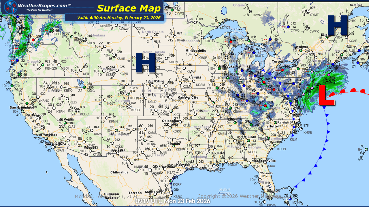
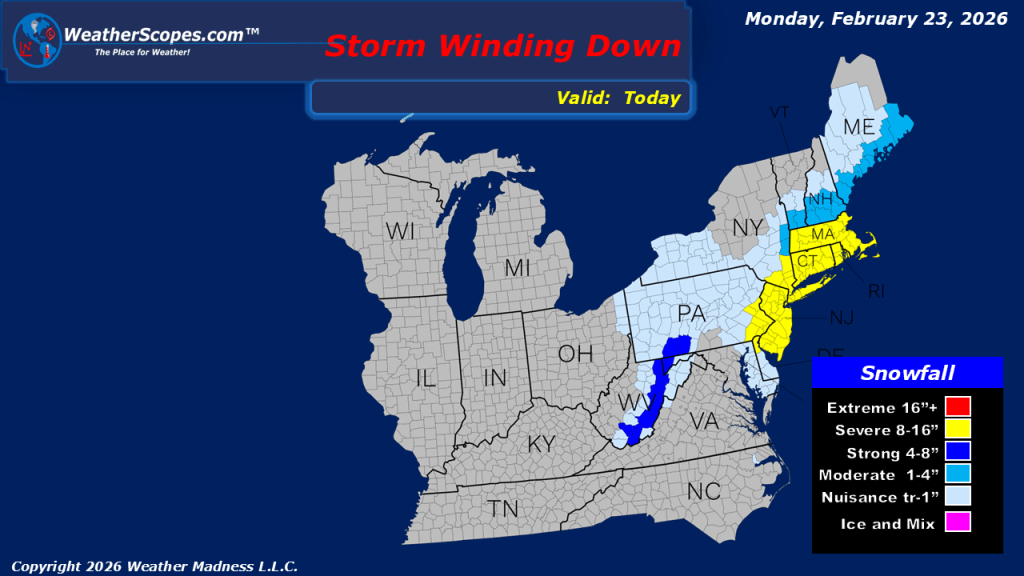
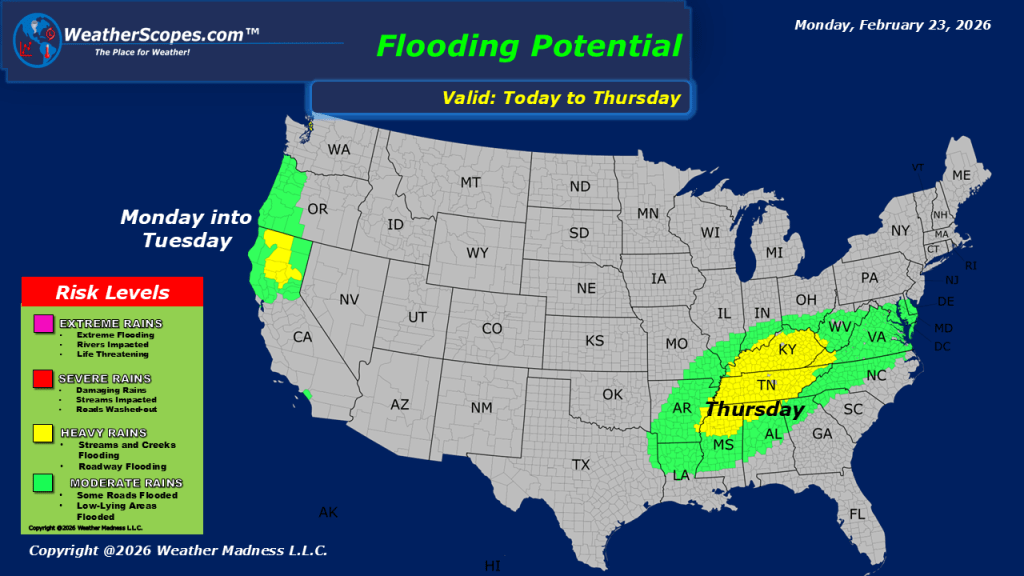
This Morning, the snowstorm that impacted much of the Mid-Atlantic and Northeast is beginning to taper off. While snowfall rates are decreasing, accumulation reports are now slowly coming in and they are impressive. From Delaware through New Jersey, into New York and up along the New England coastline, many communities have measured close to a foot of snow. In some localized areas, totals have already reached 15 to 16 inches. The storm system will continue tracking northeast through the day, gradually pulling away from the region. Lingering snow showers and breezy conditions may persist for a time, but overall impacts will steadily diminish. By later tonight, the system is expected to fully exit, allowing conditions to quiet down across much of the Northeast. Across the Great Lakes, attention turns to lake effect snow developing today. Most areas downwind of the lakes will see light accumulations, generally a coating to perhaps an inch. However, northwest Indiana stands out as an area to monitor more closely. Localized bands could produce 1 to 4 inches of snowfall, and in a very small corridor extending from northwest Indiana into southwest Michigan, isolated totals over 4 inches cannot be ruled out. Colder air is also returning to the eastern half of the country this week. After many locations experienced milder-than-average temperatures last week, a more seasonable and at times below-average air mass will settle in. This shift will reinforce winter conditions and keep temperatures feeling noticeably colder compared to recent days. The Pacific Northwest will remain active. Showers are expected today and again tomorrow, bringing periods of steady rainfall. While widespread flooding is not anticipated at this time, localized flooding could develop in areas that experience heavier downpours or have poor drainage.

Leave a comment