
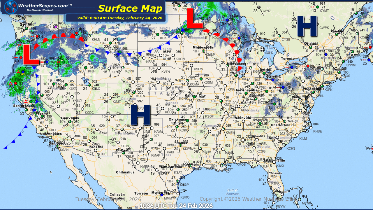
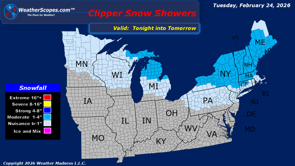
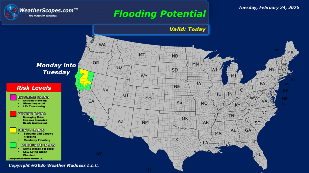
This morning, we are seeing some rain continue to impact the Pacific Northwest and into Northern California, where the area could see some localized flooding from the rain that has fallen over the last few days. Saturated ground conditions combined with additional precipitation may lead to ponding on roadways, rises on small streams, and minor flooding in low-lying or poor drainage areas. Farther inland, winter weather remains active across parts of the northern tier. We are seeing snow across the Upper Great Lakes moving to the east, and it will impact the Northeast tonight and into tomorrow. Accumulations look to be light, with a coating to four inches in most areas. While totals are not expected to be significant, even light snowfall can create slick travel conditions, particularly during the overnight and early morning hours. In the Northern Rockies, snow is also expected today as another disturbance moves through the region. Mountain passes could see accumulating snowfall, leading to winter driving conditions at higher elevations. Communities across Idaho, western Montana, and northwestern Wyoming may experience periodic bursts of snow, with locally higher totals in favored upslope areas. Cold air continues to hamper the eastern part of the United States. Below-average temperatures persist from the Plains through the Midwest and into the Mid-Atlantic.

Leave a comment