
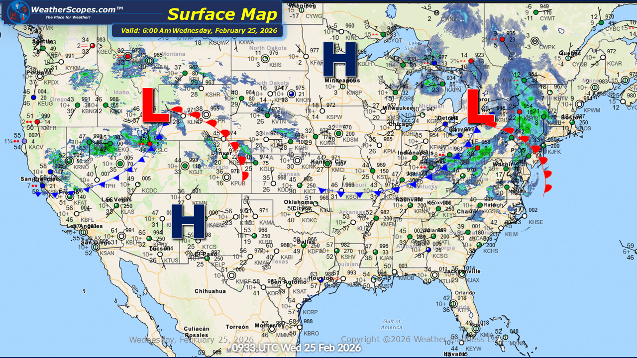
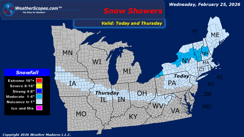
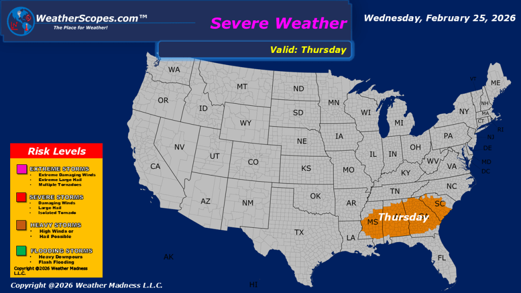
This morning, showers and gusty conditions are moving through the West, while snow continues in the higher elevations of the Rockies, creating hazardous travel conditions in mountain passes and surrounding areas. Wind gusts will be in the 40-50s. Farther east, a clipper is tracking through the Great Lakes and into parts of the Northeast. This fast-moving disturbance is expected to bring a light but measurable snowfall, with many communities likely to see a coating to 2–3 inches of accumulation. Looking ahead, additional wintry weather is expected to develop across parts of the central United States. Overnight tonight and into tomorrow, snow will move into areas of the Midwest, stretching from the Plains through the Midwest and into the Ohio Valley. This system is expected to bring a light coating to an inch of snow to the region, which could result in minor travel impacts, particularly during the morning commute. At the same time, attention turns to the Southeast, where severe weather is forecast to return tomorrow. A strengthening system may bring gusty storms to the area, with the potential for locally strong winds and heavy rainfall.

Leave a comment