
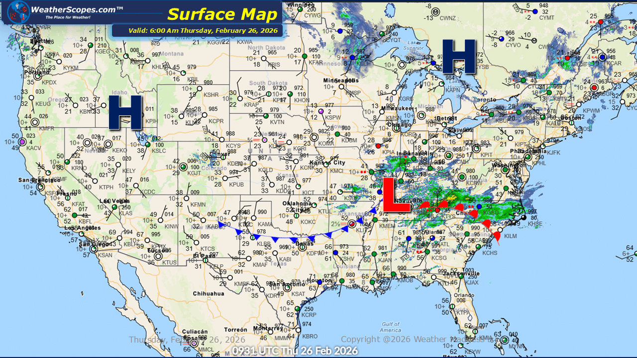
This morning, we are seeing some showers come through the Southeast into the Mid-Atlantic states. Just to the north in the Ohio Valley there is some light snow falling. Accumulations will be light with a coating at most, primarily on grassy and elevated surfaces. Additional light snow is moving through the Upper Great Lakes, where accumulations will range from a coating to 2 inches. While snowfall totals remain modest, motorists should remain mindful of locally slick conditions, particularly during the morning and evening hours. Out West, the primary concern continues to be wind. Gusty conditions persist, with gusts reaching into the 40 to 50 mph range in some areas. These winds may lead to difficult travel for high-profile vehicles and could contribute to isolated power disruptions. Cold air remains firmly in place from the Plains through the Midwest and into the Northeast. A slight warm-up comes today and tomorrow in these regions, with temperatures climbing into the 40s and 50s. However, this moderation will be short-lived, as colder air is expected to return heading into the weekend.

Leave a comment