
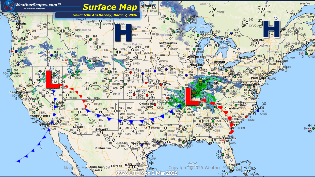
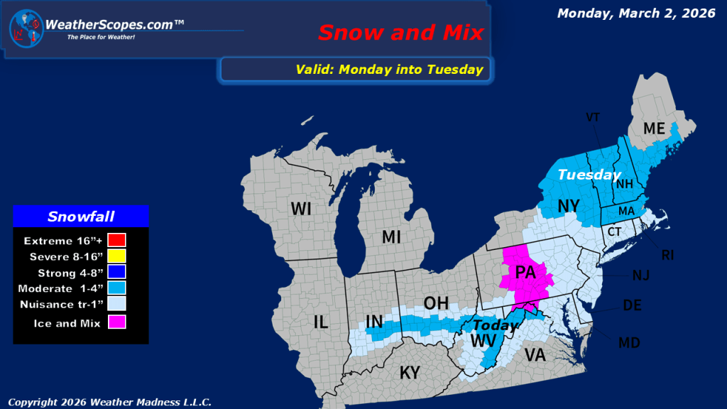
This morning, we are seeing a system come through the Tennessee Valley into parts of the Southeast and Mid-Atlantic states. Areas to the north will see some mixed precipitation and some snow, while areas south will see rain. Snow accumulations look to be light, and with milder temperatures in place, the snow will not accumulate significantly in most locations. Many areas can expect a coating to around 1 to 1.5 inches at most, primarily on grassy and elevated surfaces. Out west, unsettled conditions continue across the Rockies, with periods of rain and snow expected today and at times throughout the week. These intermittent systems will bring typical late-winter variability to higher elevations, while lower elevations may see more rain than snow depending on local temperatures. Looking ahead, a gradual warming trend is in store for much of the eastern portion of the country.

Leave a comment