
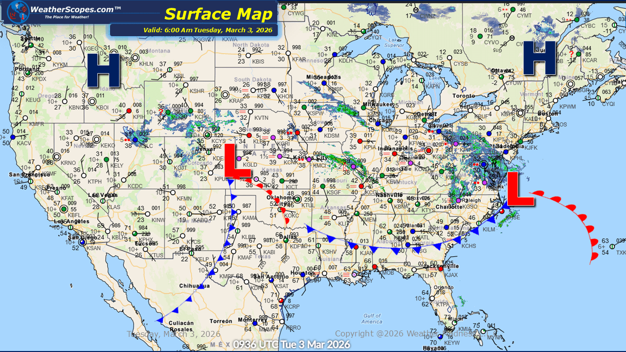
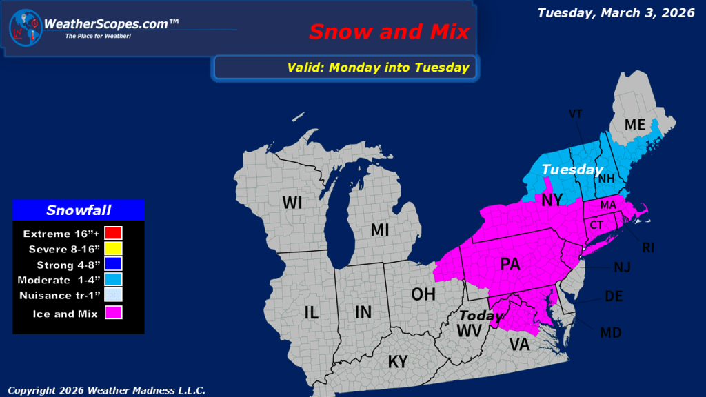
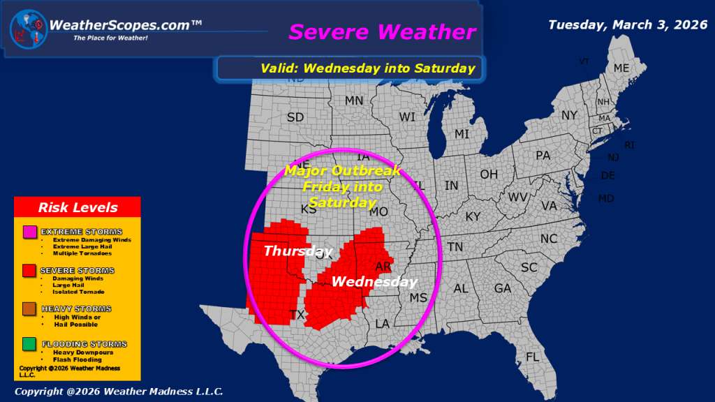
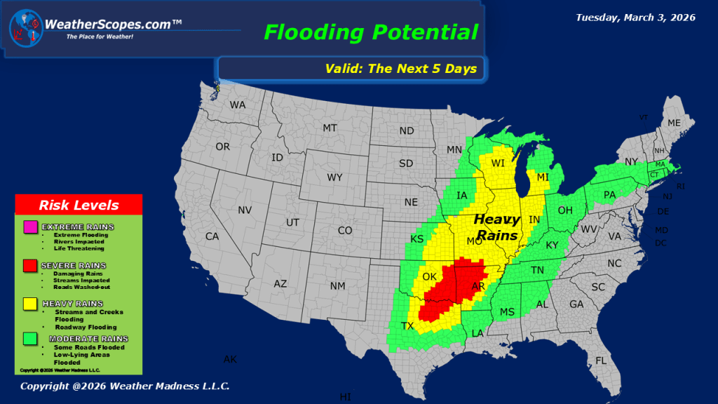
This morning, we are seeing rain and some freezing rain come through the Northeast. Some areas could be slick and icy this morning, making travel dangerous. Motorists should exercise caution, particularly on untreated roads, bridges, and overpasses where icy patches can develop quickly. Some showers this morning across southern Illinois are moving east through the Ohio Valley today and will reach the Northeast tonight. While much of this precipitation is expected to fall as rain. Later today and into tonight, the rain/snow mixed precipitation will move farther north, bringing snow to southern Pennsylvania, New York, and into Vermont, New Hampshire, and Maine. Snow accumulations of 1 to 4 inches are possible in these areas, which could create additional travel concerns, especially during the overnight hours. Out west, snow will continue across the Rockies today, leading to winter driving conditions in higher elevations and reduced visibility at times. Temperatures are trending milder across much of the eastern United States. While the warmest air remains farther south, many areas will see temperatures rise above freezing. This gradual warming may help limit prolonged icing in some locations, though slick spots could persist where freezing rain has already occurred. Looking ahead, we continue to watch portions of Texas into Oklahoma and the Mississippi Valley where severe weather will break out starting tomorrow and persist throughout the week.

Leave a comment