
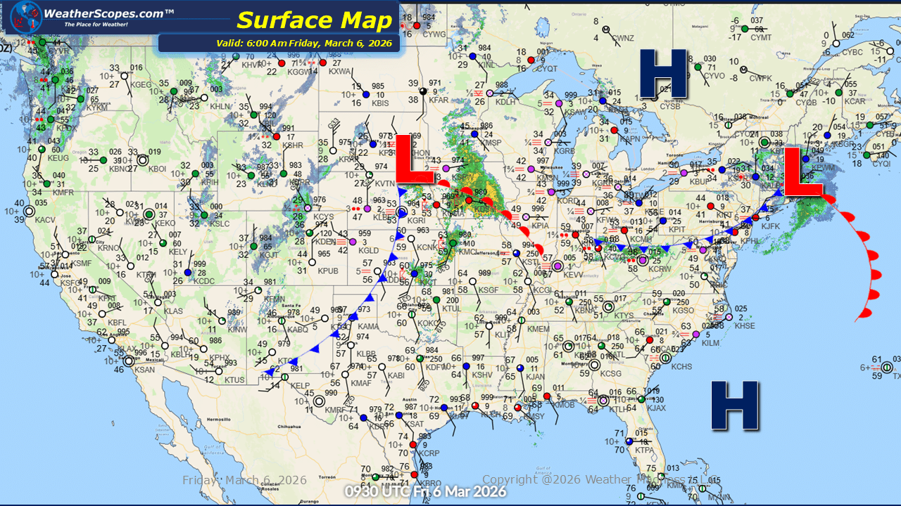
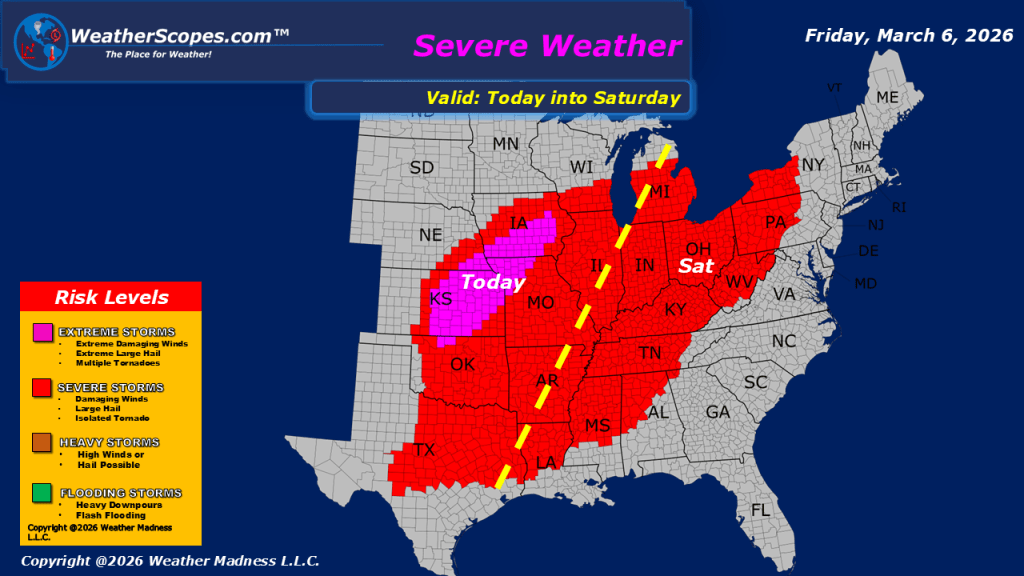
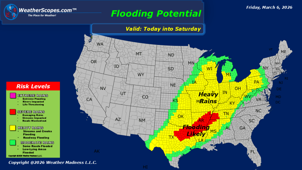
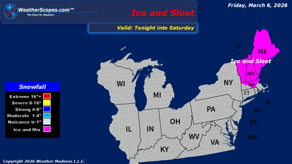
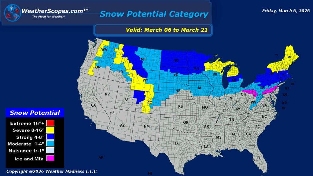
This morning, showers and thunderstorms are moving through parts of the Midwest and Ohio Valley, with some storms already producing small hail. Additional rounds of storms are expected to develop this afternoon and evening across the Midwest, the Mississippi Valley, and extending south into Texas. Most of these storms will become severe, bringing the potential for damaging winds, hail, locally heavy rainfall, and tornadoes. The Plains will likely see the greatest risk for severe weather today, where atmospheric conditions may support the development of tornadoes. With multiple rounds of thunderstorms expected, widespread rainfall will accompany these systems across much of the central United States. The repeated rainfall may lead to localized flooding in some areas, particularly where storms track over the same locations. Winter weather continues across the western United States. The Rockies are seeing another round of snow, and the Denver metro area may finally pick up measurable snowfall today, with totals of around 2 to 4 inches possible. For much of the eastern US, we will see milder temperatures, while parts of the Southeast could experience temperatures near or even breaking daily records for early March.

Leave a comment