
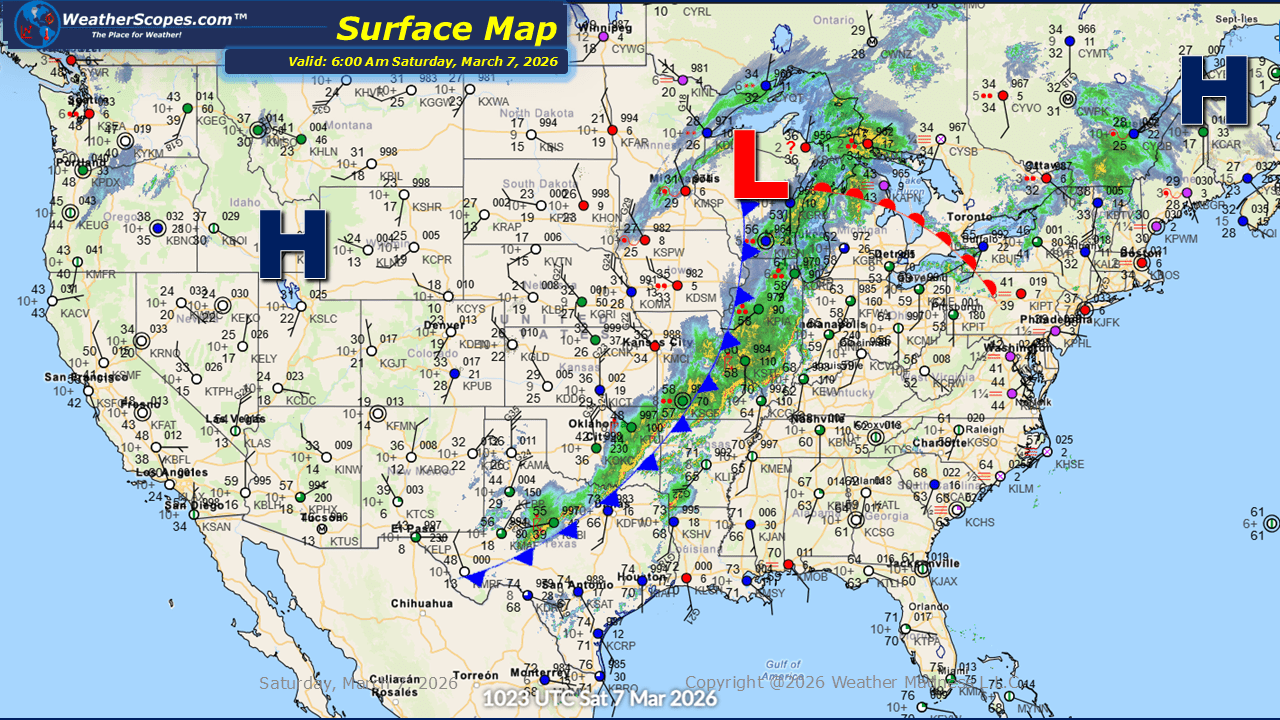
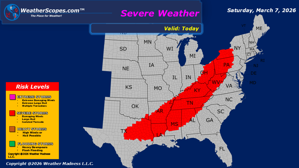
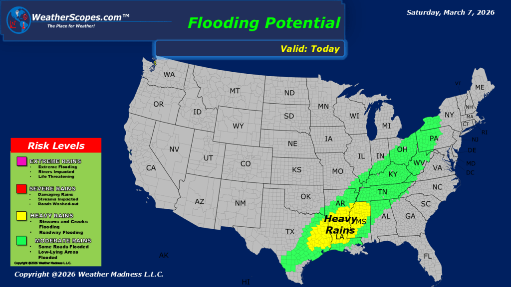
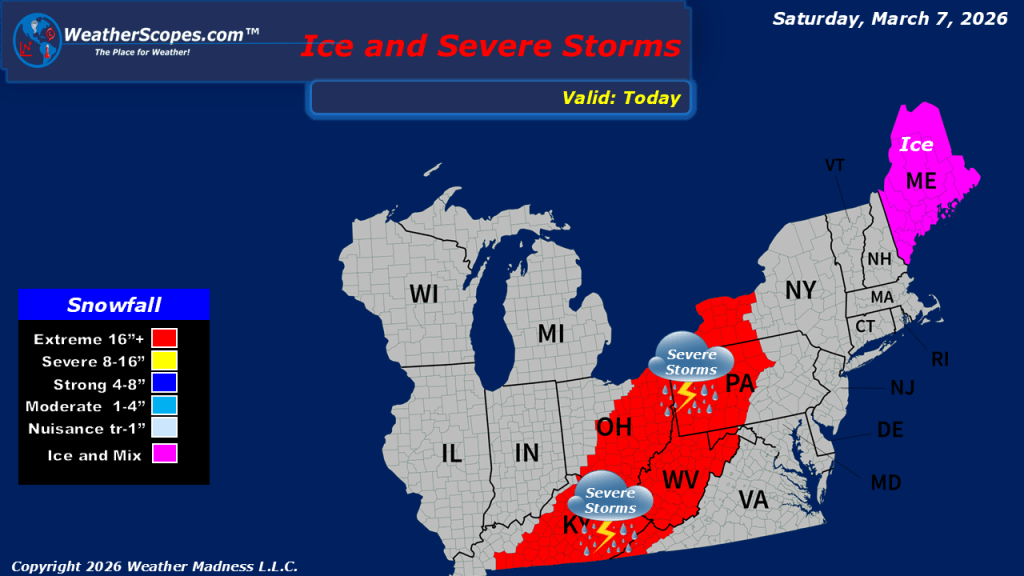
This morning, snow and mixed precipitation are moving through the Upper Great Lakes this morning, bringing light accumulations generally ranging from a coating up to around 1 inch. While the snowfall is relatively minor, it marks a noticeable shift in conditions across the region as a cold front begins to move through, leading to cooler temperatures later today. Farther south, the primary weather story will be the continuation of severe weather. Following numerous severe storm and tornado reports yesterday, additional storms are expected to develop and move eastward along a corridor stretching from western Pennsylvania down to Texas. As these systems track east, new storms may form along the same path, raising the possibility of more severe weather throughout the day. Milder temperatures will remain in place across much of the eastern United States, providing the warm and unstable conditions that can support strong thunderstorms. Areas across the Upper Great Lakes will begin to see colder air filtering in behind the advancing cold front. Heavy rainfall associated with these storms continues to raise concerns about localized flooding in some areas. Repeated rounds of storms could lead to periods of intense rainfall, especially in locations already saturated from earlier precipitation.

Leave a comment