
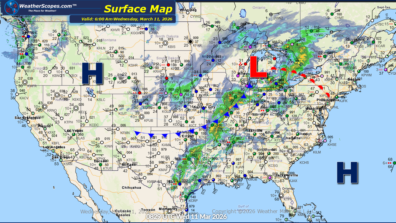
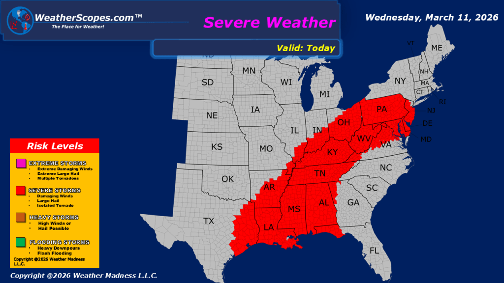
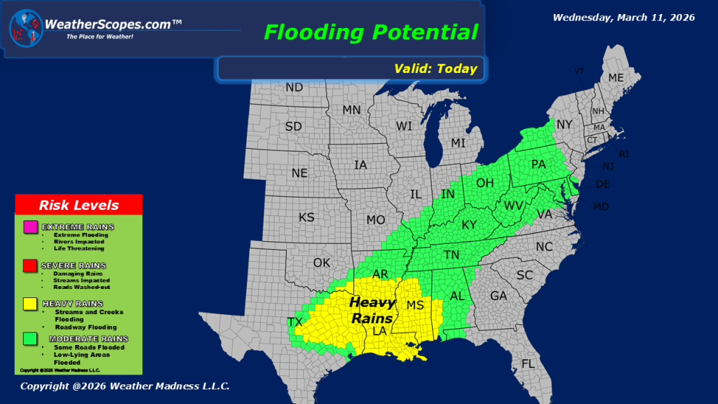
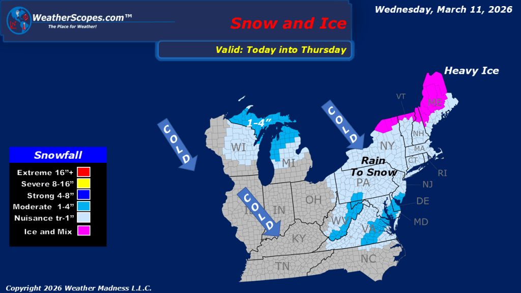
This morning we are seeing showers and thunderstorms in the Midwest and moving into the Ohio Valley, after multiple reports of tornadoes yesterday across the area. This system will continue to bring unsettled conditions through the day. From the Ohio Valley into parts of Texas and the Lower Mississippi Valley, we can expect the same potential for severe weather, with all hazards in play. This includes the risk for damaging winds, large hail, heavy rainfall, and the possibility of additional tornadoes as the system advances eastward. We will also have to watch the potential for some localized flooding with this system producing heavy rainfall. Behind the front, a much colder air mass is moving in. Parts of the Great Lakes could see some flurries today with a coating in some areas, and as much as 1-4” in parts of Northern Wisconsin and the UP of Michigan. We will also see ice in Northern Michigan and parts of Vermont, New Hampshire, and Maine later tonight. Meanwhile, showers continue across the Pacific Northwest, with the Northern Rockies seeing periods of snow. Temperatures are also trending cooler across the Northern Plains into the Great Lakes after the region recently experienced milder conditions. The return to below-average temperatures will be noticeable for many communities as this colder air settles in through the middle of the week.

Leave a comment