
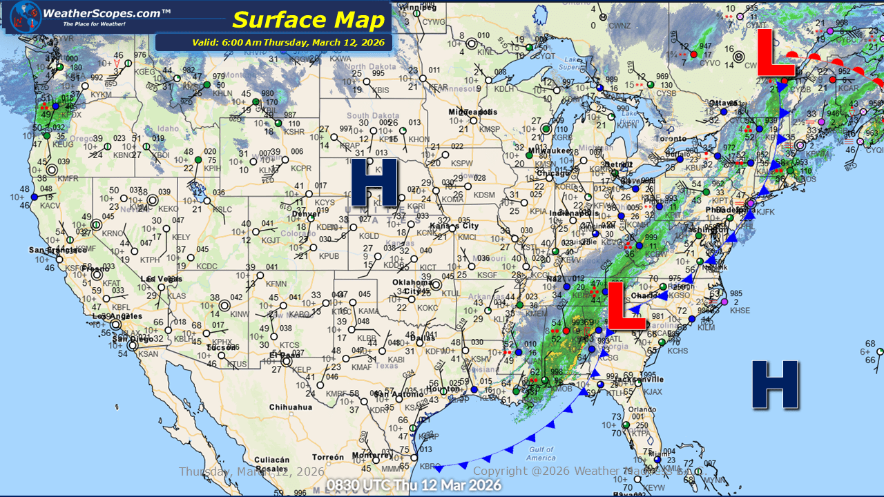
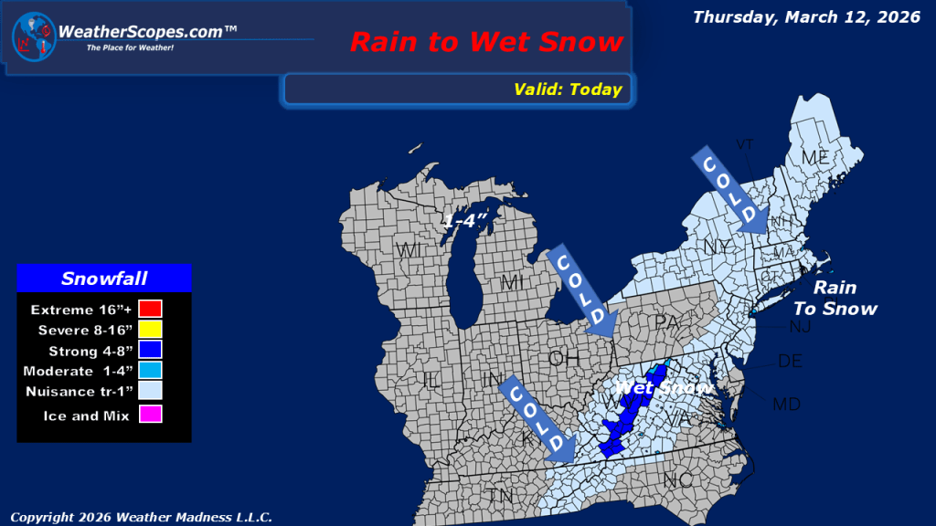
This morning, we are seeing showers and thunderstorms out ahead of a cold front moving through the New England area, stretching south along the Mid-Atlantic states and all the way through the Southeast. As this system continues to push eastward and move out into the Atlantic, colder air wrapping in on the back side will allow precipitation to transition to snow in some areas. Parts of the Northeast through the Virginias and portions of the Mid-Atlantic states could see a coating to as much as 2 inches of snow, particularly along the higher elevations of the Appalachians. While snowfall totals will remain light overall, the changeover from rain to snow may lead to slick spots in elevated terrain. Farther west, snow is already developing this morning across portions of the Northern Plains. This system is expected to track eastward into the Upper Great Lakes later tonight and into tomorrow. Most areas will see accumulations of 1 to 4 inches, with locations closer to the Canadian border potentially receiving more than 4 inches. Across the western United States, unsettled weather continues as well. Additional showers and snow are expected in the higher elevations of the Northern Rockies and across parts of the Pacific Northwest, where cooler and active conditions persist. Colder weather is returning to the eastern part of the country after several days of very mild and pleasant temperatures. As the cold front moves through, gusty conditions will also develop across the Northern Plains, where wind gusts between 50 and 60 mph + will be possible, creating potentially hazardous travel conditions in open areas.


Leave a comment