
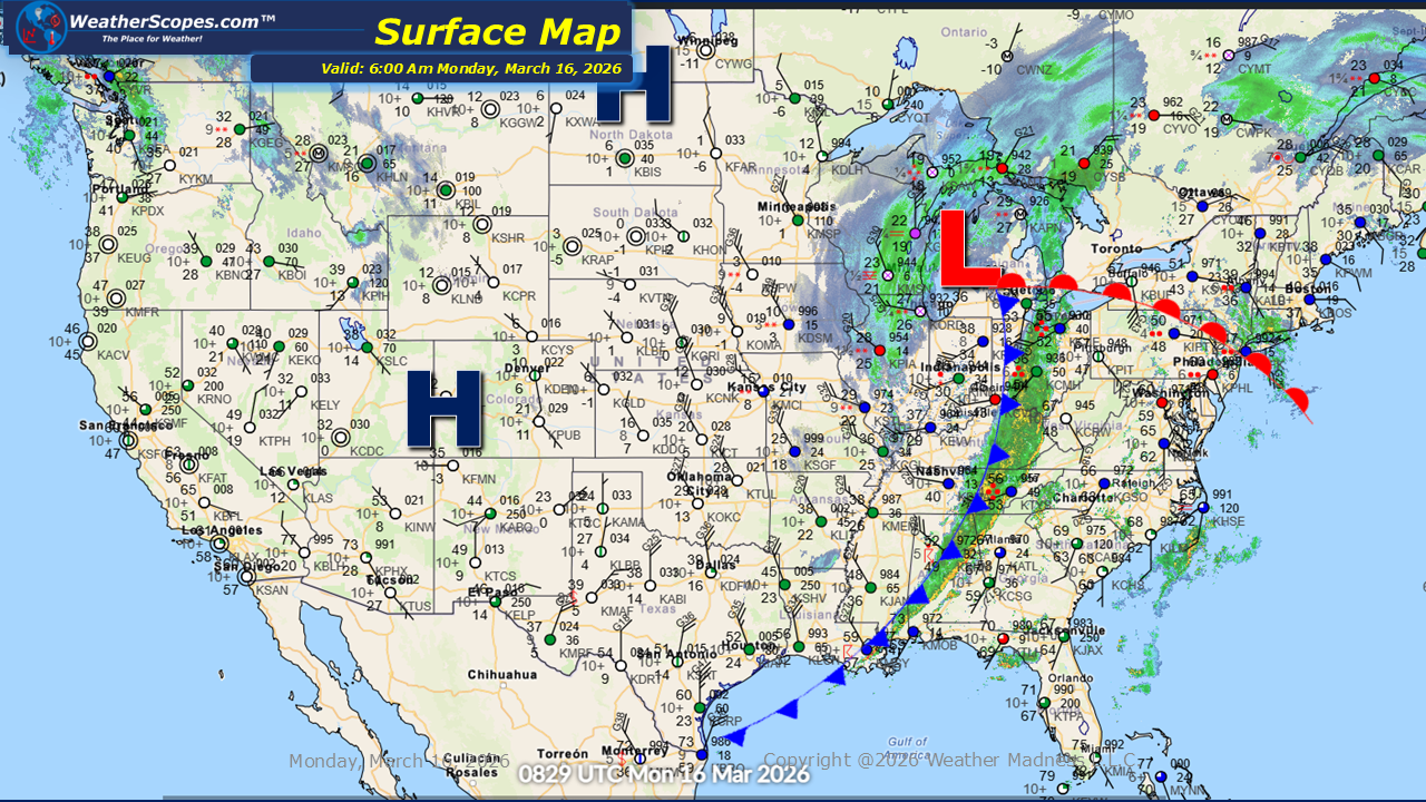
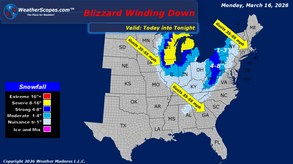
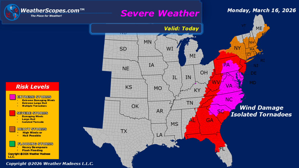
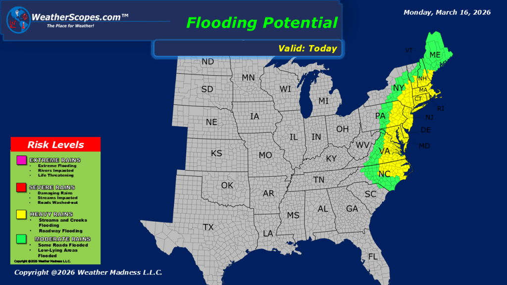
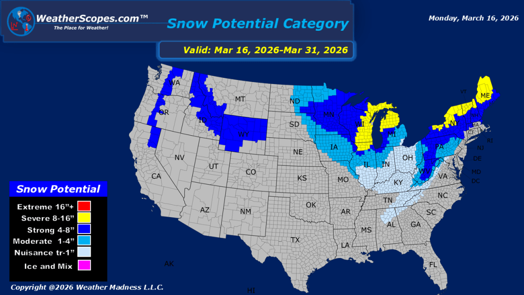
This morning, we are seeing blizzard-like conditions across parts of the Midwest as snow continues on the backside of the strong system that moved through yesterday bringing widespread showers and thunderstorms. Accumulations across many areas are expected to fall in the 1–4 inch range, with some locations seeing totals exceeding 4 inches. Central Wisconsin continues to experience snow and blizzard conditions, and some areas across the state have already recorded more than 24 inches of snowfall from this system. Attention turns to the Mid-Atlantic states for potential severe weather. The Mid-Atlantic down through parts of the Southeast will see storms develop and move through the region today. These storms could bring all hazards, including damaging winds, large hail, and the potential for tornadoes. With the amount of moisture associated with this system, localized flooding will also be possible as periods of heavy rain move through. Later tonight and into tomorrow, parts of the Northeast and Mid-Atlantic will see snow develop on the backside of the same system responsible for the severe weather farther south. As the storm exits the region, colder air and gusty winds will follow behind it, bringing a noticeable drop in temperatures. Looking ahead toward the latter part of the week, the eastern half of the United States will begin to see milder conditions return as the pattern moderates and temperatures trend upward once again.

Leave a comment