
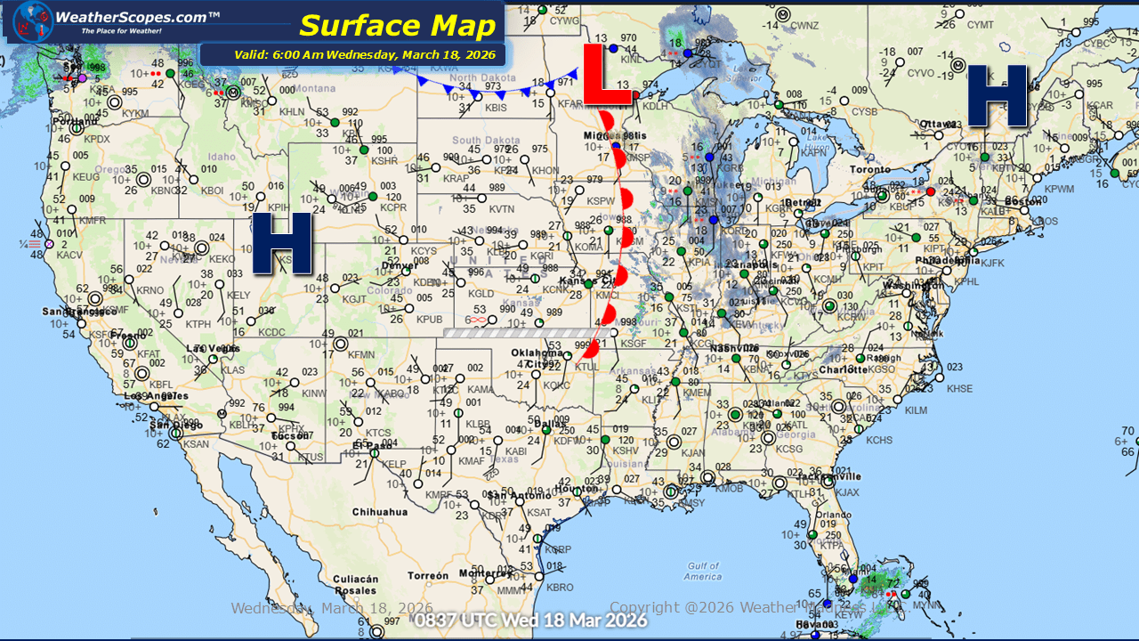
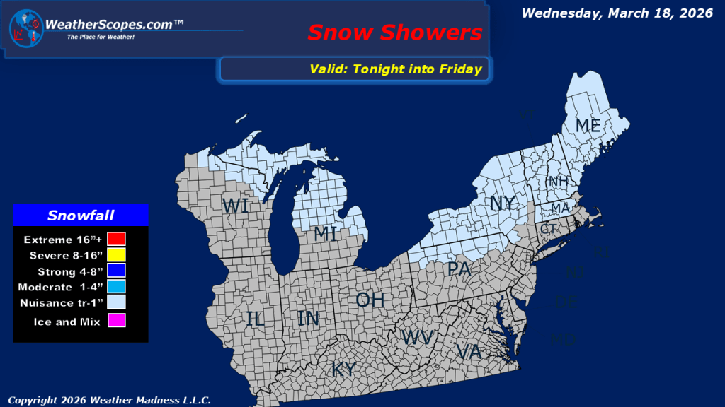
This morning, we are seeing snow showers come through the Midwest and Upper Great Lakes. Light accumulations with this clipper are expected, generally ranging from a coating to around one inch. Cold weather is still impacting the Plains through the Midwest and into the Northeast, maintaining a firm grip across much of the region. However, there is light at the end of the tunnel this week, with milder conditions beginning to move into the area starting tomorrow, signaling a gradual shift toward more moderate temperatures. Out in the Pacific Northwest, showers will continue today, bringing additional rainfall to the region and maintaining a damp pattern. Much of the Southwest will see warm temperatures today. Southern California into Arizona will see temps in the 90s and some areas reaching the 100s. Looking ahead to later tonight and into the overnight hours, a system will track through parts of Minnesota into Wisconsin, bringing rain along with the potential for some icing overnight. Portions of Wisconsin could also see flurries associated with this system.

Leave a comment