
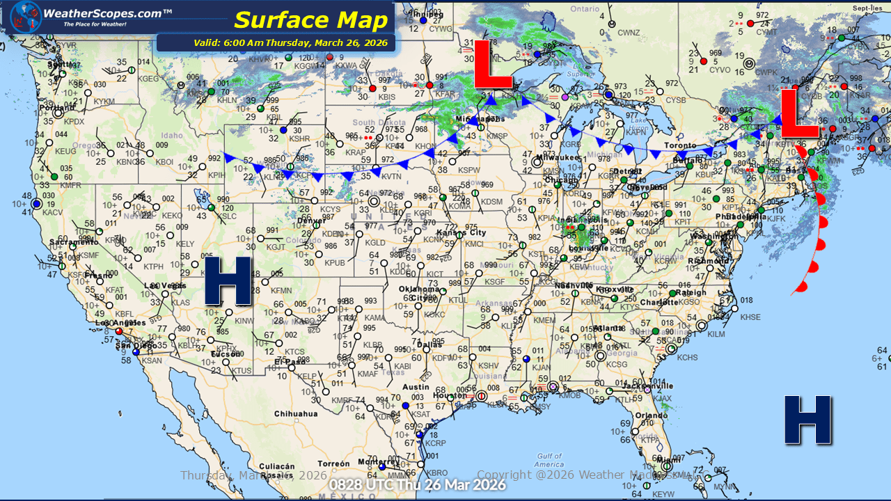
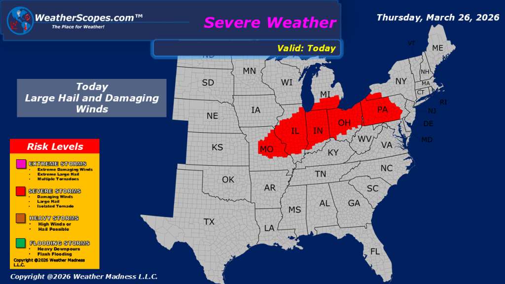
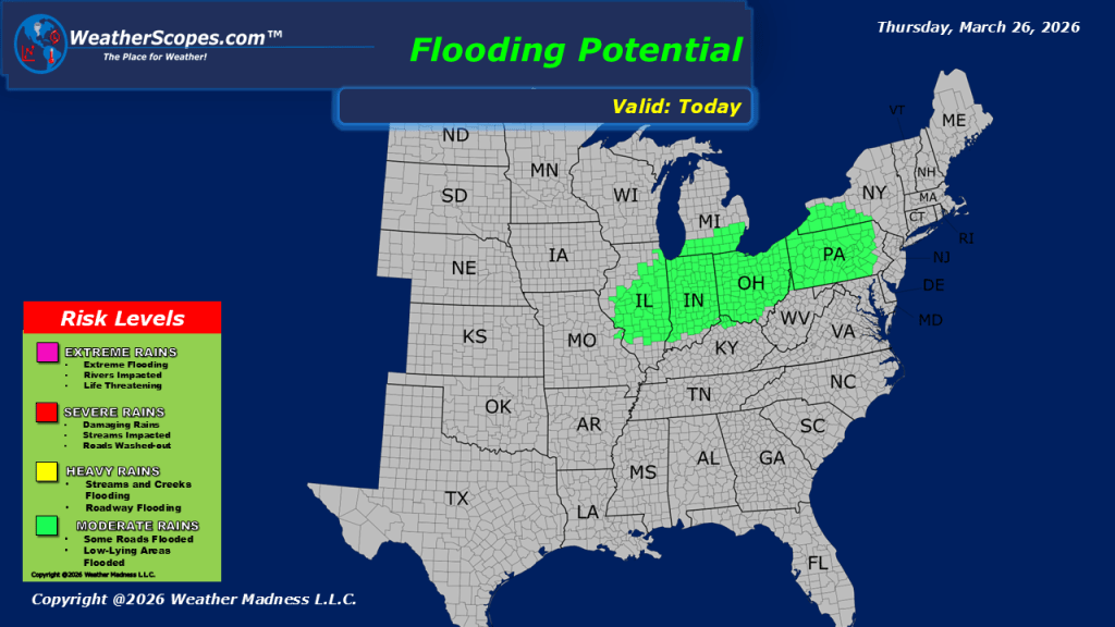
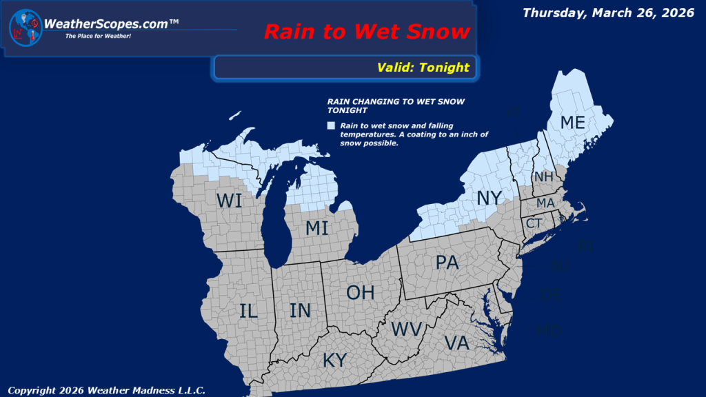
This morning, we are seeing showers come across the Great Lakes and some pop up showers through West Virginia. These early precipitation patterns are setting the stage for a more impactful weather scenario later in the day. As we move into the afternoon and evening hours, a cold front advancing through the Midwest will create conditions favorable for severe weather development. With these storms, we can see hail, gusty conditions, and heavy downpours, which could lead to some localized flooding and even a possible tornado. Residents in affected areas should remain alert and monitor local forecasts as conditions evolve. Behind this system, a noticeable shift in temperatures is expected. After several days of relatively mild conditions, colder air will settle into the Northern Plains, Great Lakes, and Northeast. This change will be particularly evident in the Upper Great Lakes, where rain is forecast to transition to snow later tonight and into tomorrow, bringing a light coating to the region.

Leave a comment