
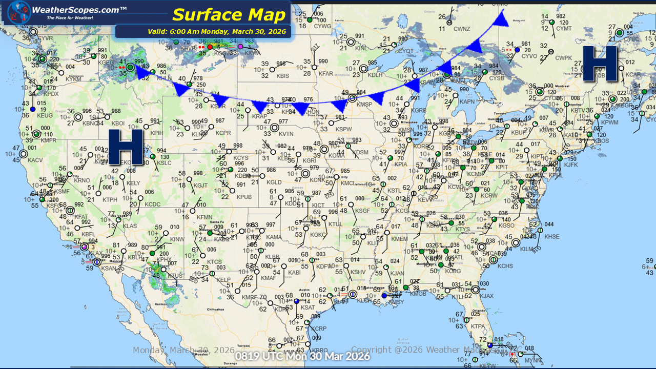
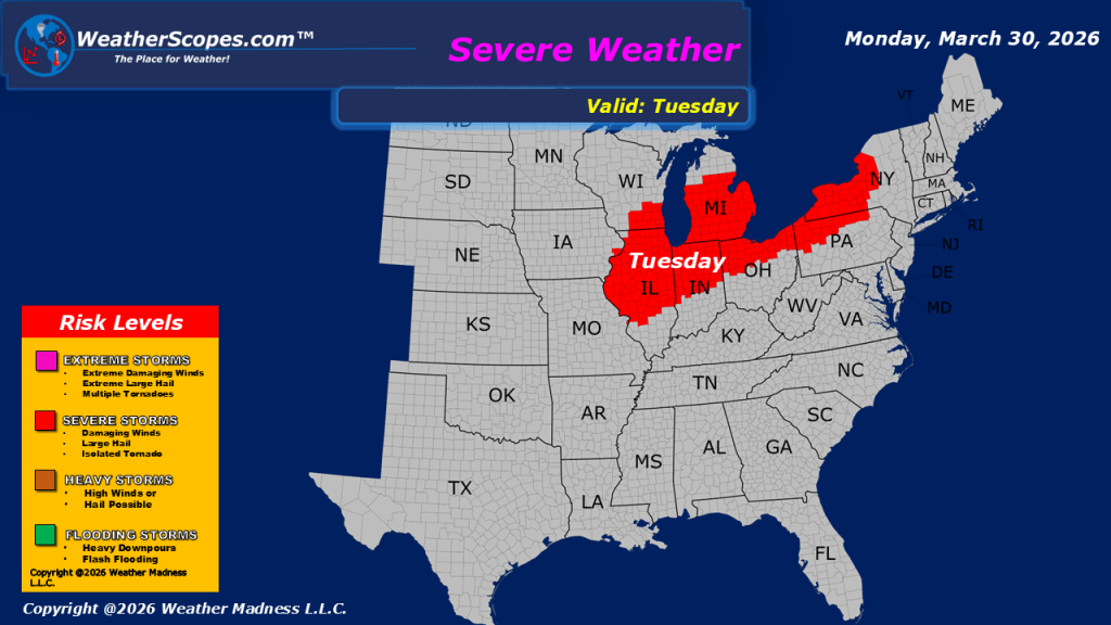
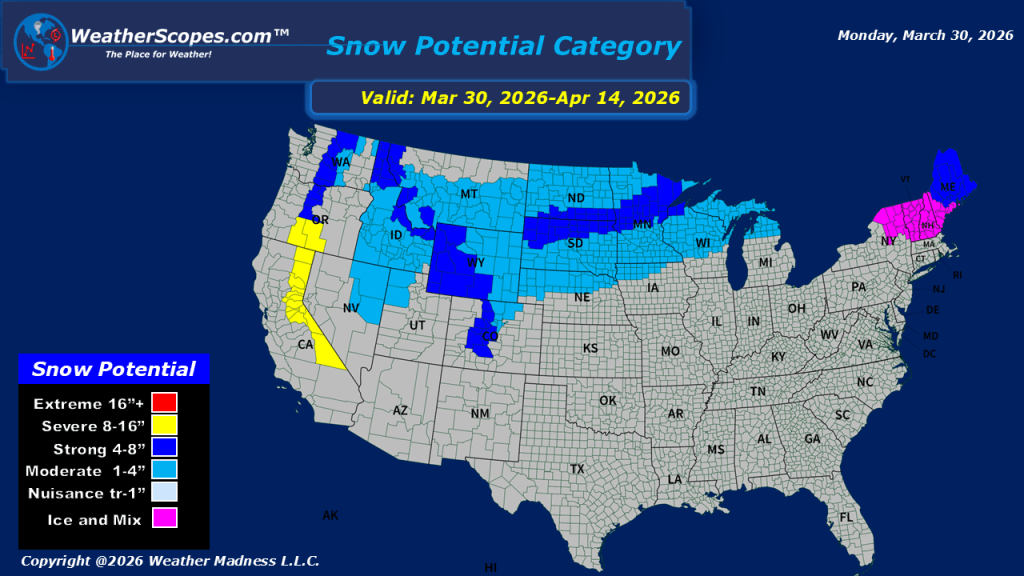
This morning, we are seeing a mix of precipitation across several regions. Showers are moving through the Washington, D.C. area, bringing a damp start to the day. Farther north, northeastern Maine is experiencing snow showers, with light accumulations expected through the day. Additional snowfall is occurring across parts of southern Canada near the North Dakota border, associated with a system that will also impact the northern portions of North Dakota, where 1 to 3 inches of snow are likely. Elsewhere, much of the United States is seeing relatively mild conditions, providing a contrast to the more active weather in the northern tier. However, this calm pattern will begin to shift later tonight. Storms are expected to develop across the Midwest and extend into the Great Lakes region during the overnight hours and extend into the Ohio Valley and parts of the Northeast. These storms may bring a risk of severe weather, a threat that is forecast to persist through the day on Tuesday as the system continues to move eastward.

Leave a comment