
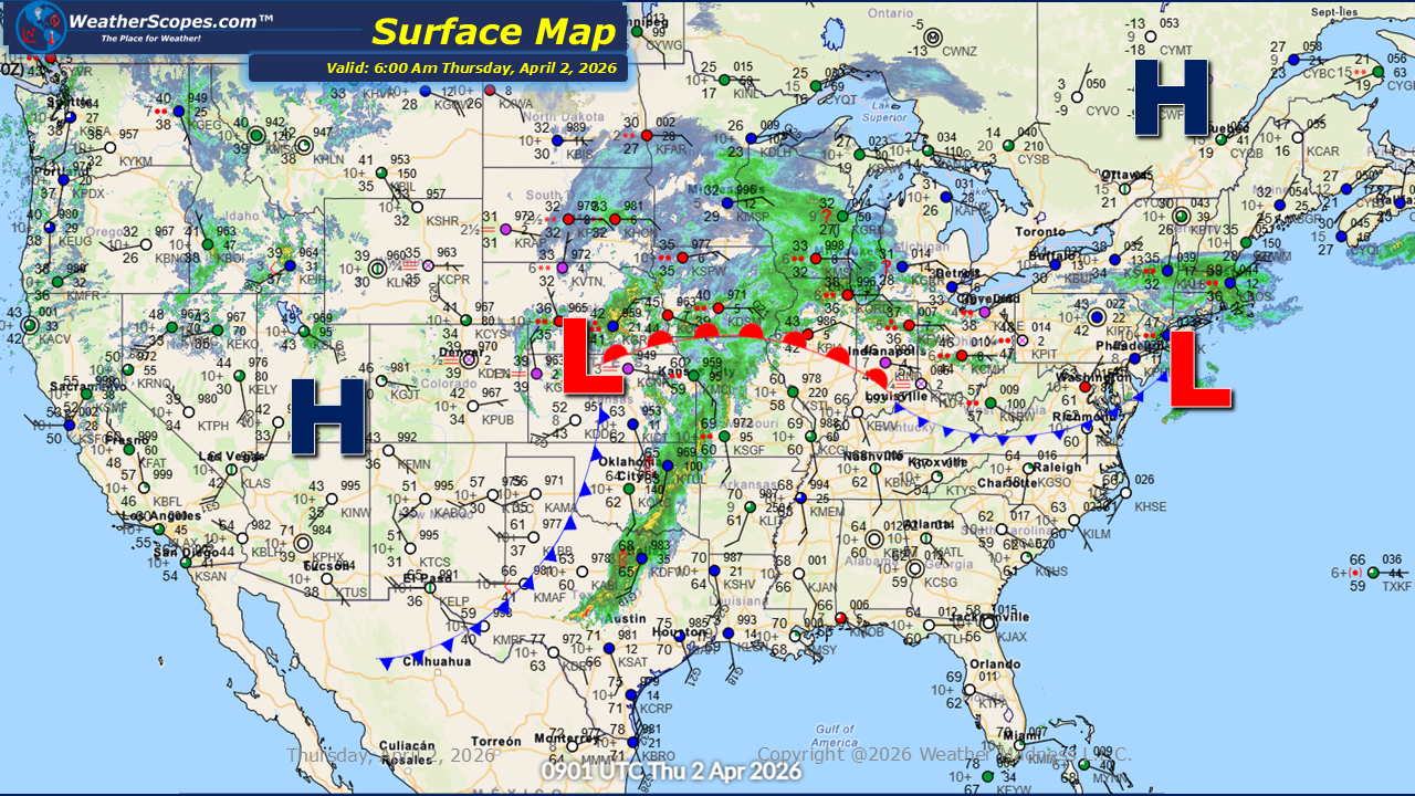
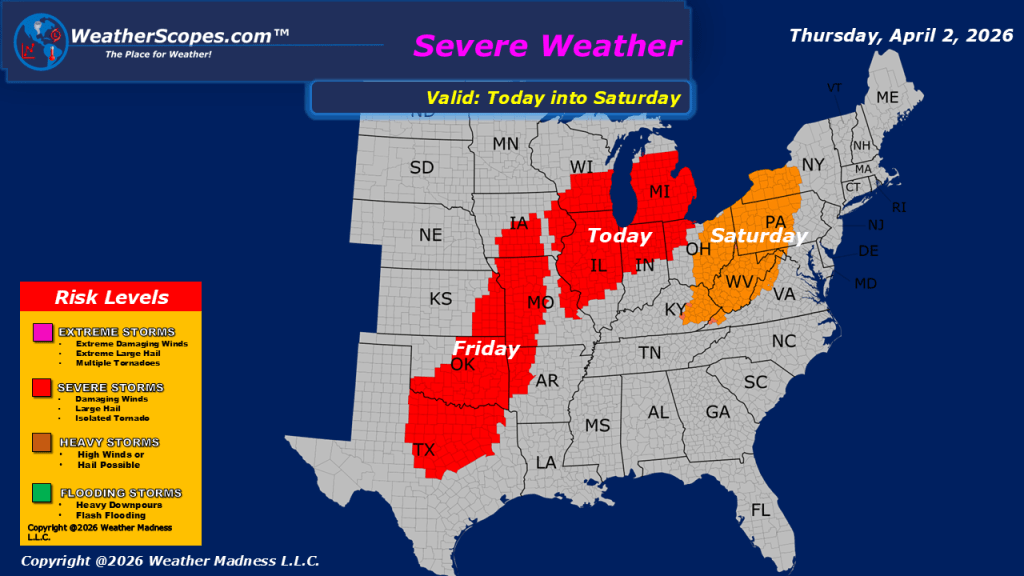
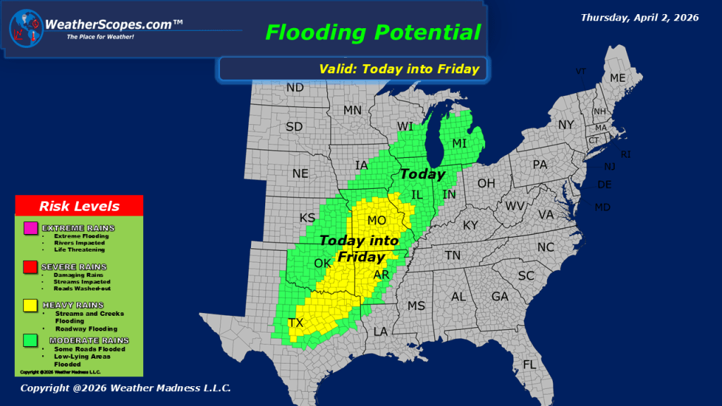
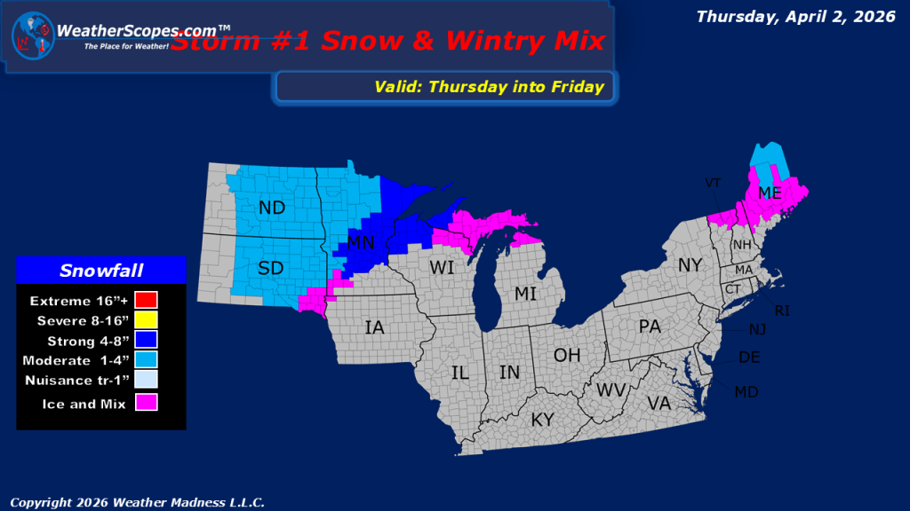
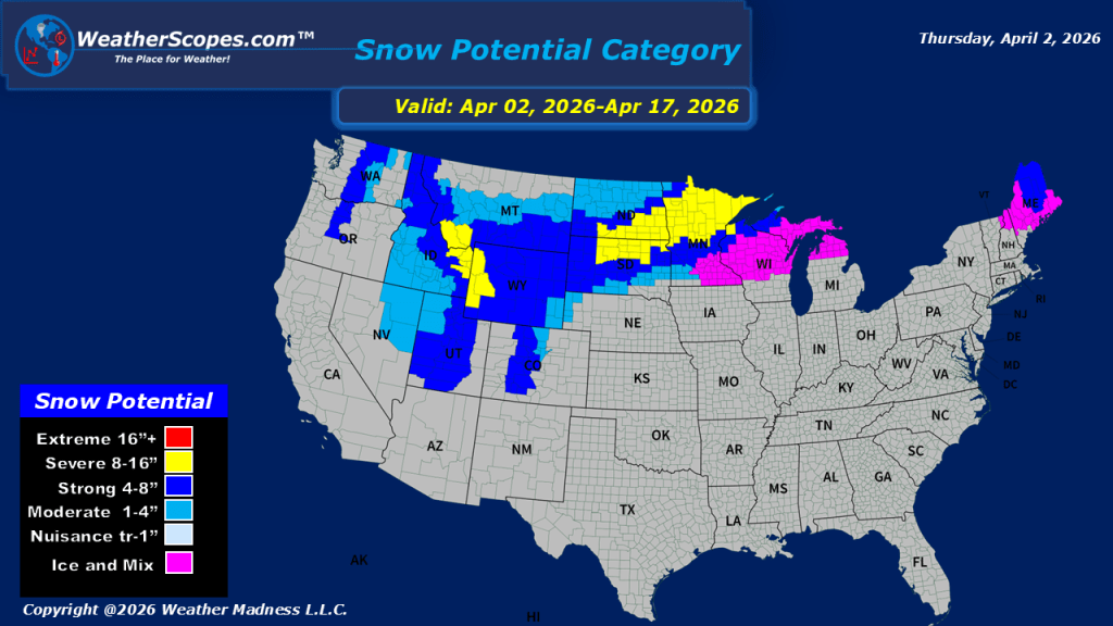
This morning, we are already seeing showers move through the Midwest and into the Great Lakes. These showers will bring some heavy downpours at times, creating wet conditions for many communities across the region. To the north of the rain, parts of northern Wisconsin, the Upper Peninsula of Michigan, and the Northern Plains are experiencing a mix of precipitation, including ice and snow. Accumulations are expected to range from around 1 to 4 inches, with some locations in Minnesota and Wisconsin potentially seeing totals exceeding 4 inches. As we move into the afternoon and evening hours, the threat for severe weather will increase across portions of the Midwest, particularly in Iowa, Illinois, and southern Wisconsin. All hazards are possible with these storms, including damaging winds, large hail, and isolated tornadoes. In addition, the heavy rainfall may lead to localized flooding in areas that receive repeated rounds of storms. Meanwhile, the Pacific Northwest will see scattered showers, with snow falling across the higher elevations of the Rockies. Much of the United States will experience relatively mild temperatures today, while colder air remains confined to northern areas, especially near the Canadian border. Looking ahead, the active weather pattern is expected to continue, with additional severe weather possible tomorrow and further snowfall likely across parts of the Northern Plains.

Leave a comment