
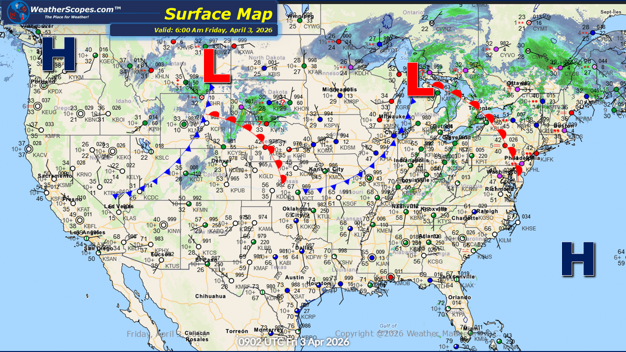
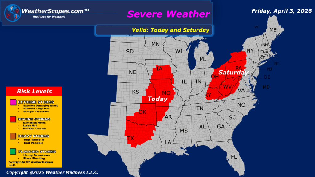
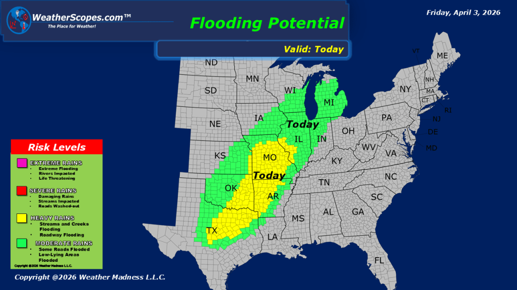
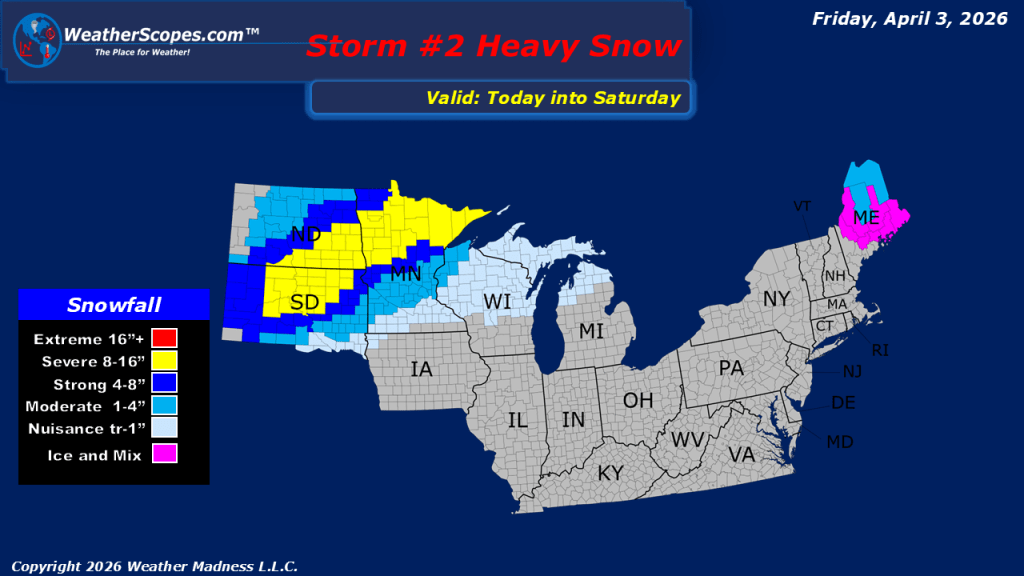
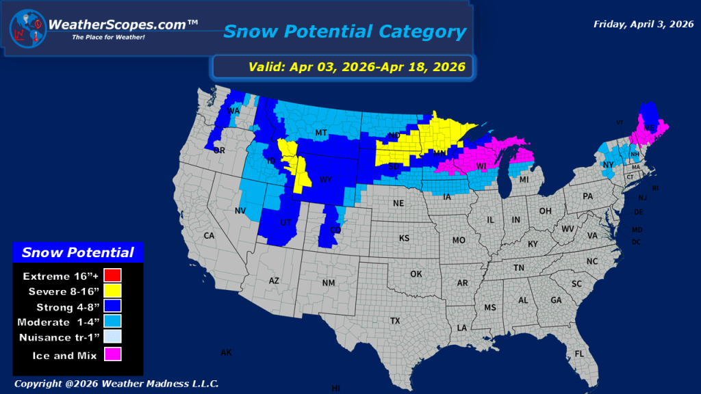
This morning, showers are moving through portions of the Northeast. As we head through the day, attention turns to the Midwest into parts of southern Texas, where another round of severe weather is expected to develop. These storms will have access to a warm, moist air mass, allowing for all hazards to be in play, including damaging winds, large hail, and the potential for tornadoes. We will also need to watch for some localized flooding with the amount of rain expected today. This will be an active setup that should be monitored closely, especially for those in vulnerable areas. Meanwhile, on the colder side of the system across the Northern Plains and into the Upper Great Lakes, winter is not quite finished. Snow is expected to continue in these regions, with accumulations generally in the 1 to 4 inch range. However, localized areas could exceed 4 inches, particularly where bands of heavier snow set up.

Leave a comment