
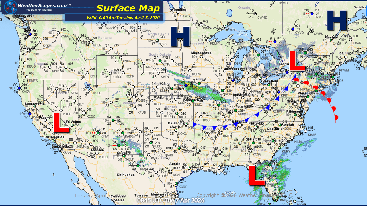
This morning, mixed precipitation is moving through western Iowa into parts of Missouri and Illinois. These areas may see light accumulations ranging from a coating up to around one inch of snow as the system progresses eastward. A clipper is tracking through the Upper Great Lakes into portions of the Northeast is bringing additional snowfall. Expected accumulations generally range from a coating to 2–3 inches across parts of upstate New York and into northern Vermont, New Hampshire, and Maine. Central portions of Maine could see higher totals exceeding three inches. Cooler conditions continue to impact the Northern Plains, Great Lakes, and Northeast. In contrast, warmer air remains in place across the southern and southwestern United States, maintaining a notable temperature divide. Wind will also be a factor today, particularly across the Northern Plains. Areas from Montana through the Dakotas and into parts of Wyoming can expect gusts between 35 and 45 mph. Scattered storms later today and into the evening hours could also impact Montana into the Dakotas, and the Four Corner States. Florida will see some scattered showers and thunderstorms throughout the day, accompanied by occasional gusty winds, which could get up to around 40mph.

Leave a comment