
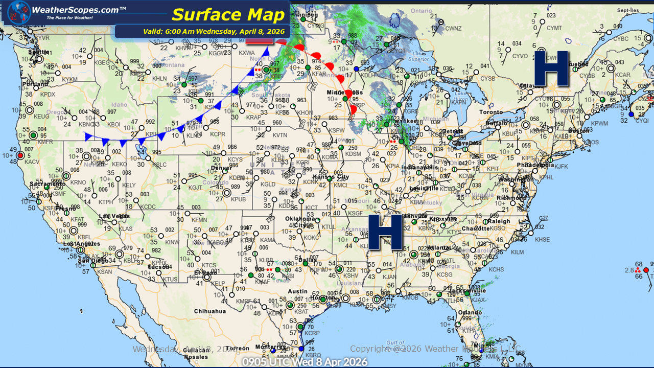
This morning, we are seeing some showers come through the Northern Plains into the Great Lakes. These systems are bringing periods of light to moderate rainfall, contributing to an active start to the day in those regions. Alongside the precipitation, gusty conditions continue across the Northern Plains into parts of the Midwest where we could see 35–45 mph gusts. These winds may create challenging travel conditions, particularly for high-profile vehicles and in open areas. Gusty conditions across Florida are also notable today, as the region continues to see some showers and thunderstorms throughout the day. These storms may bring brief downpours and occasional lightning. Looking ahead into tonight, scattered showers are expected across Northern California, adding to the broader pattern of unsettled weather. At the same time, parts of the Great Lakes could see overnight storms come through, potentially bringing additional rainfall and isolated thunderstorm activity during the late evening and overnight hours. Despite these areas of active weather, milder conditions are in place across much of the United States today. Temperatures are generally trending above seasonal averages for many locations, offering a more comfortable feel overall. The cooler air will stay well to the north near the Canadian border, keeping the chill largely confined to those northernmost areas.

Leave a comment