
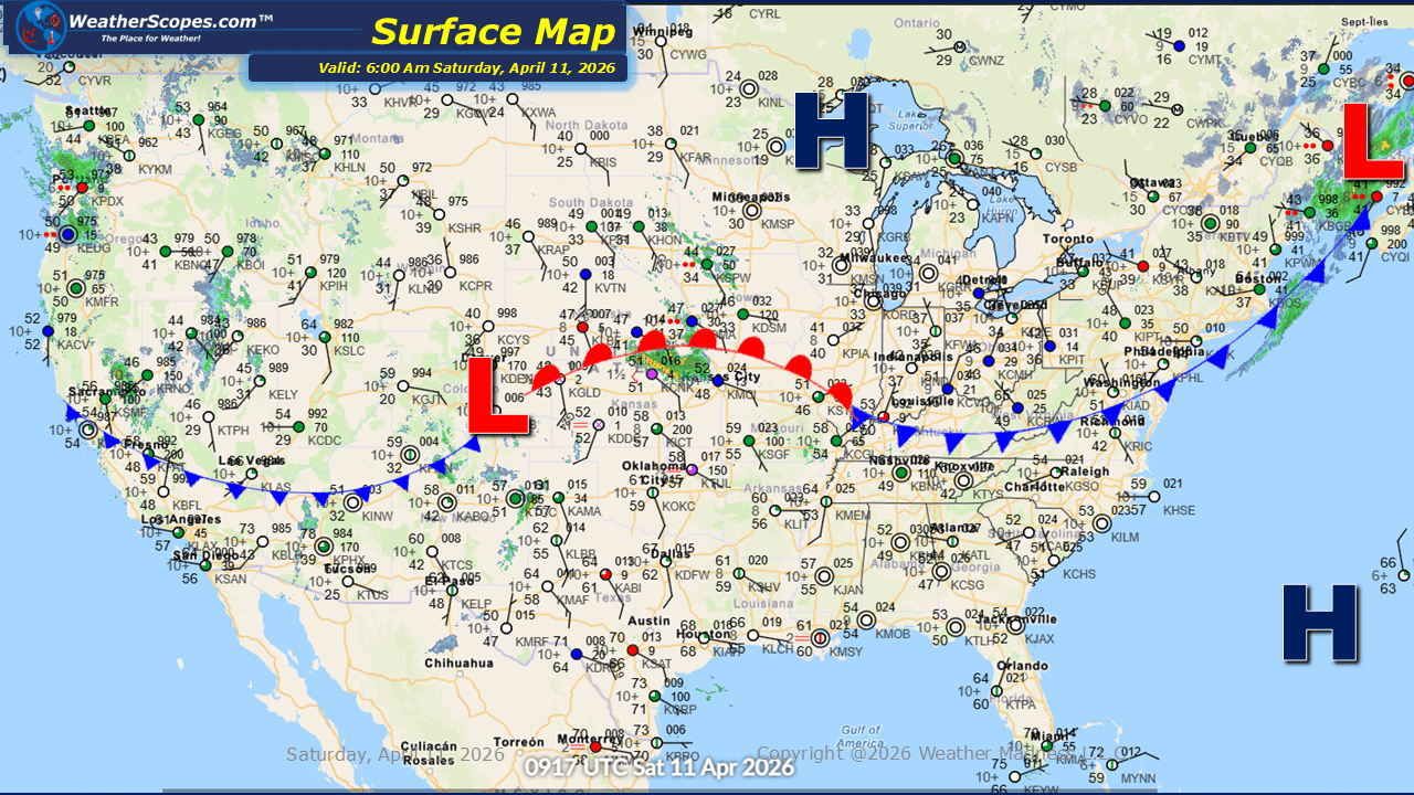
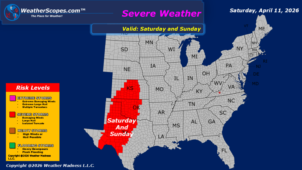
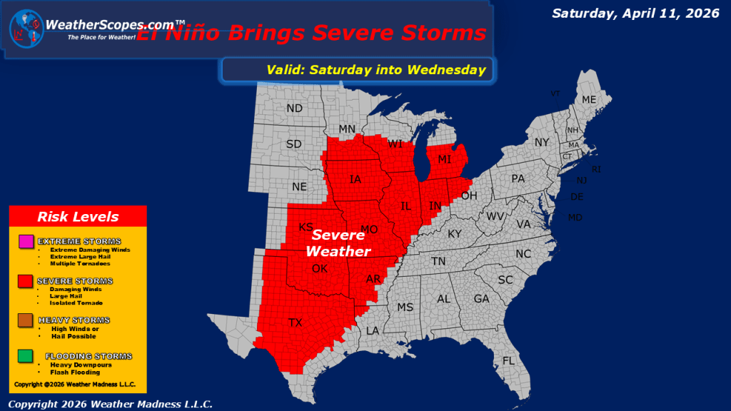
This morning, we are seeing showers across parts of the Midwest, along with additional precipitation moving through the Pacific Northwest. The showers in the Midwest are expected to gradually shift northward throughout the day, impacting areas across Wisconsin and Minnesota by the afternoon hours. Meanwhile, a broad swath of the western United States extending into the northern Plains will experience breezy to gusty conditions. Wind gusts in these regions may reach between 35 and 45 mph, creating locally challenging travel conditions and increasing fire weather concerns in more vulnerable areas. Farther south, attention turns to the southern High Plains, particularly across the Texas Panhandle and southeastern New Mexico. Atmospheric conditions in this region are becoming favorable for the development of severe weather. Storms that form may bring heavy rainfall, strong wind gusts, and the potential for hail. Looking ahead, the overall weather pattern remains active and will continue to support periods of heavy rain and severe weather over the next several days. The primary corridor for this activity stretches from Texas northward and eastward into portions of the Great Lakes, where repeated rounds of precipitation could lead to accumulating rainfall and an increased risk of flooding in some areas. Temperatures across much of the country remain on the mild side for this time of year. However, cooler air continues to linger in areas closer to the Canadian border, where conditions are noticeably colder compared to regions farther south.


Leave a comment