
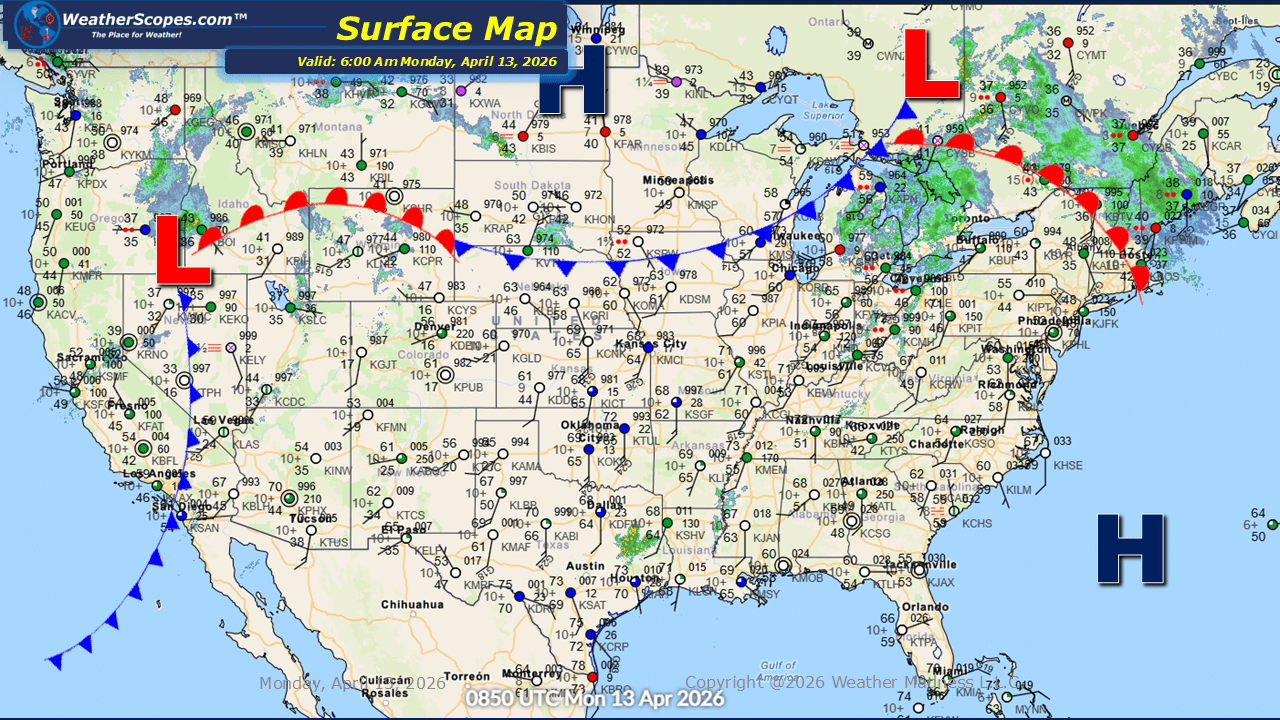
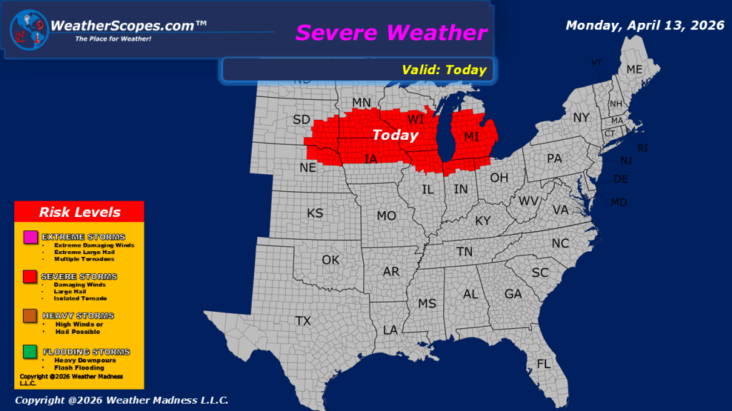
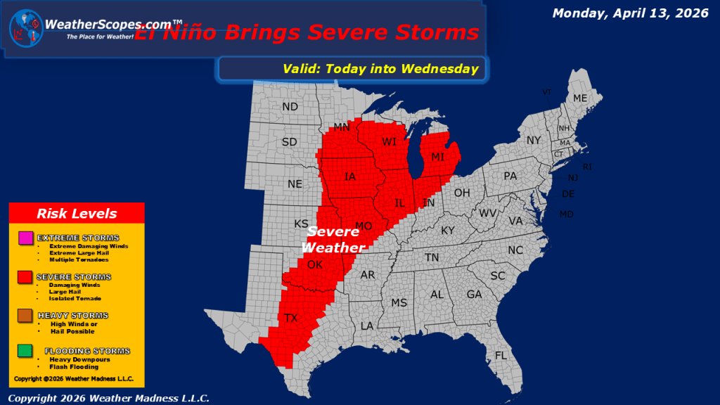
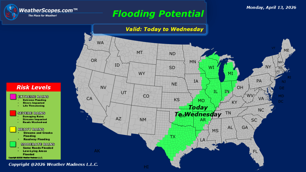
This morning, showers are moving through portions of the Northeast, while additional precipitation is occurring across parts of the Pacific Northwest. In the northern Rockies, colder conditions will support snowfall in the higher elevations throughout the day. Attention then shifts to the Upper Midwest, where conditions are expected to become increasingly favorable for severe weather development later today and into the overnight hours. Areas across Minnesota, northern Wisconsin, and into Michigan may experience strong storms capable of producing gusty winds, hail, and heavy downpours. An isolated tornado cannot be ruled out. This pattern is part of a larger system that will bring multiple days of severe weather potential across the Midwest, extending into the Plains and southern Plains through the week. Residents in these regions should remain attentive to forecast updates as conditions evolve. In the Southwest, showers are expected to develop later tonight, adding to the overall unsettled pattern across the country. In terms of temperatures, much of the central and eastern United States will experience warm conditions today. Cooler, but still relatively mild air will remain in place across portions of the Northeast and northern Plains. Out West, temperatures will trend cooler overall, consistent with the ongoing unsettled conditions in that region.

Leave a comment