Daily Maps Saturday April 4th, 2026

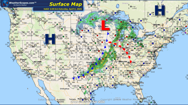
This morning, we are seeing some showers and thunderstorms come through the Ohio Valley and Upper Great Lakes, and extending south into Texas. As the day progresses, some of these storms could intensify and become severe, particularly from the Mississippi Valley into the Ohio Valley. Wind, hail, and heavy rainfall will be the primary threats,... Continue Reading →

Daily Maps Friday April 3rd, 2026

This morning, showers are moving through portions of the Northeast. As we head through the day, attention turns to the Midwest into parts of southern Texas, where another round of severe weather is expected to develop. These storms will have access to a warm, moist air mass, allowing for all hazards to be in play,... Continue Reading →

Daily Maps Thursday April 2nd, 2026

This morning, we are already seeing showers move through the Midwest and into the Great Lakes. These showers will bring some heavy downpours at times, creating wet conditions for many communities across the region. To the north of the rain, parts of northern Wisconsin, the Upper Peninsula of Michigan, and the Northern Plains are experiencing... Continue Reading →

Daily Maps Monday March 30th, 2026

This morning, we are seeing a mix of precipitation across several regions. Showers are moving through the Washington, D.C. area, bringing a damp start to the day. Farther north, northeastern Maine is experiencing snow showers, with light accumulations expected through the day. Additional snowfall is occurring across parts of southern Canada near the North Dakota... Continue Reading →

Website Powered by WordPress.com.

Up ↑