
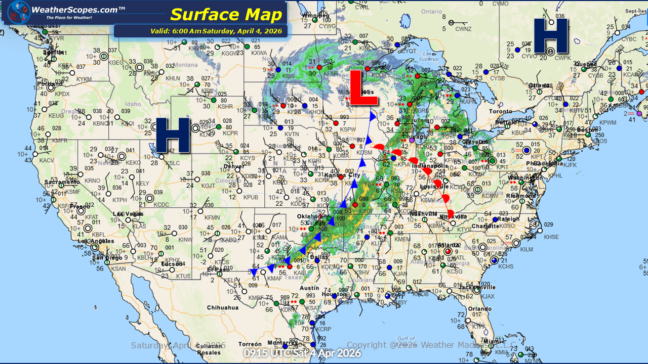
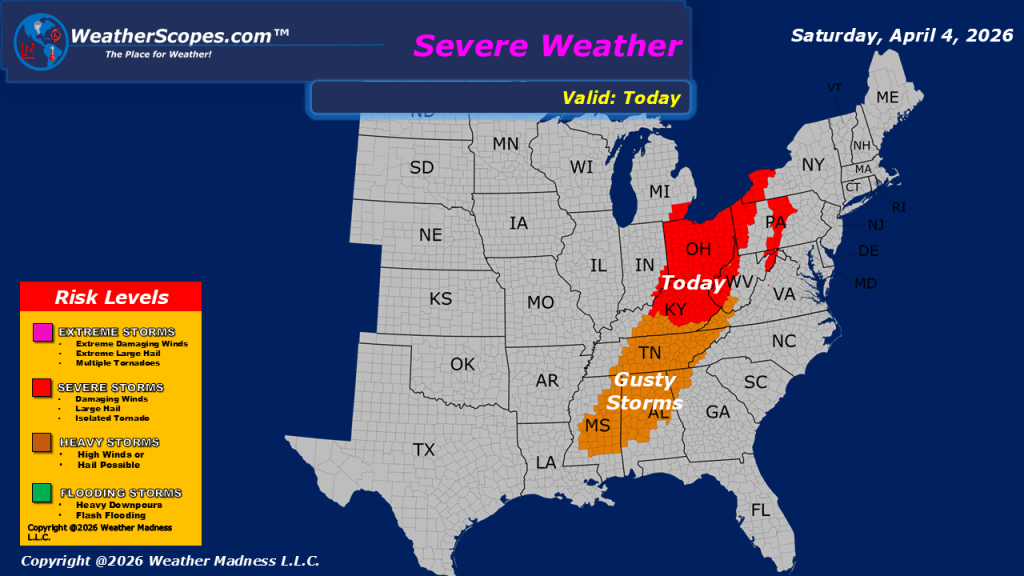
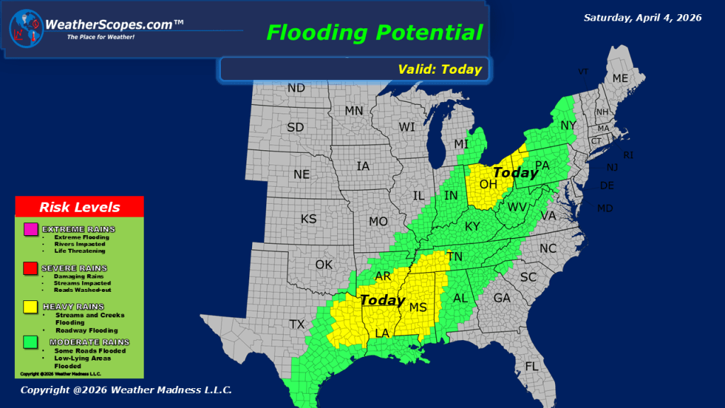
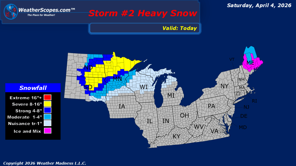
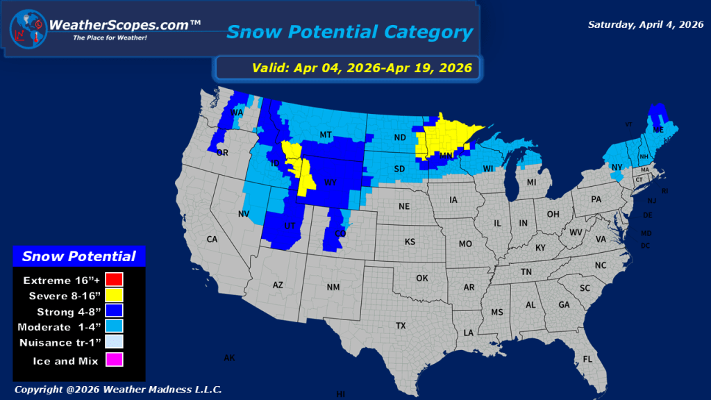
This morning, we are seeing some showers and thunderstorms come through the Ohio Valley and Upper Great Lakes, and extending south into Texas. As the day progresses, some of these storms could intensify and become severe, particularly from the Mississippi Valley into the Ohio Valley. Wind, hail, and heavy rainfall will be the primary threats, creating the potential for localized damage and flooding concerns. While a tornado cannot be ruled out, the probability appears lower compared to the past few days. Meanwhile, a much different story is unfolding across the Northern Plains, where cold air and wintry precipitation are dominating the forecast. The Dakotas into parts of Minnesota and northern Wisconsin are expected to see snow along with periods of mixed precipitation. Accumulations will be around 1 to 4 inches, though areas near the North Dakota–South Dakota border and portions of northern Minnesota could receive more significant totals exceeding 7 to 8 inches. Looking ahead, this colder pattern is not expected to ease quickly. Cooler-than-average temperatures are likely to settle back in during the coming week across the Northern Plains, extending through the Great Lakes and into the Northeast, reinforcing a wintry feel for early spring in these regions.

Leave a comment