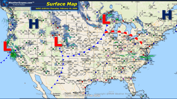
This week’s weather pattern will be active across much of the northern and eastern United States, driven by a series of fast-moving clipper systems. The first clipper will move through the Plains on Sunday before tracking across the Great Lakes and into the Northeast by Monday, bringing periods of light snow and reinforcing colder air.... Continue Reading →
Daily Maps Sunday February 1st, 2026
This morning, a clipper system is moving through the Plains and is expected to track into the Upper Great Lakes later tonight into tomorrow. Snow accumulations look to be around a coating up to 3 inches in some areas. The remnants of the system that produced snow across the Carolinas is moving offshore but continues... Continue Reading →
Daily Maps Friday January 30th, 2026
This morning, light snow is occurring across the Plains, with accumulations ranging from a light coating up to 1 inch. Lake-effect snow will once again impact the Great Lakes region today, with the heaviest accumulations expected in the Upper Peninsula of Michigan, the Buffalo area, and southeastern Wisconsin into the Chicago metro area. Most locations... Continue Reading →
Daily Maps Thursday January 29th, 2026
This morning, a clipper system is moving through the Plains, producing a light coating of snow. Lake-effect snow continues to impact the Great Lakes region today, with accumulations of 4 inches or more in areas closest to the lakes. Arctic cold remains entrenched across the Plains, Great Lakes, and Northeast, with temperatures well below zero... Continue Reading →
