Daily Maps Saturday February 15th, 2025

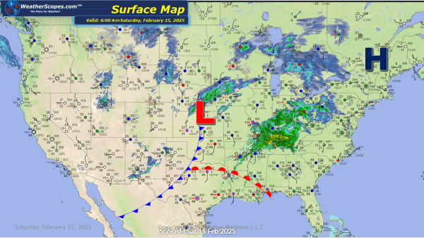
Snow continuing today in the Midwest, Great Lakes and into the Northeast. Accumulations look to be a coating to 4''. Higher amounts in the Northeast, Michigan, and parts of Nebraska. Along with the snow moving through, some mixed precipitation and ice will accompany it in areas of the Ohio Valley. Later today some strong storms... Continue Reading →

Daily Maps Thursday February 13th, 2025

Snow continues in the Northeast today from the storm yesterday. Parts of update NY, Vermont, NH, and Maine could see snow accumulations of 8''+. Areas south could see a coating of snow and some rain as well. The Boston area could see some freezing rain. Some lake effect snow in the Great Lakes with some... Continue Reading →

Daily Maps Wednesday February 12th, 2025

Our second snowstorm of the week is making its way through the Plains and Midwest. It will continue to move to the east and impact the Great Lakes and Northeast. Heaviest accumulations look to be 4-8'' for portions of Kansas to the Great Lakes and into the Northeast, and some areas of the interior areas... Continue Reading →

Daily Maps Tuesday February 11th, 2025

Some light lake effect snow this morning in the Great Lakes. Accumulations look to be a coating. We have our 1st snow storm of the week going through Kentucky and the Virginia's, making its way to the coast and the Baltimore area. The main accumulation for this storm will be 4-6'' with 1-4'' further north... Continue Reading →

Website Powered by WordPress.com.

Up ↑