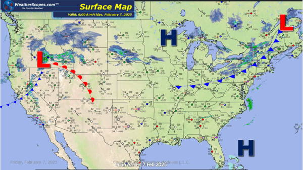
Some snow over the Upper Great Lakes parts of the Northeast today. Accumulations look to be around a coating to 3''. Snow also over Montana moving towards the Plains later today and will set the stage for a weekend storm for the Great Lakes. Accumulations in the Northern Plains look to be a coating to... Continue Reading →
Daily Maps Thursday February 6th, 2025
Today, the system that went through parts of the Midwest producing some freezing rain, will continue into the Northeast. This system will bring ice and sleet then turn into snow from NY to Maine. Snow accumulations look to be a dusting to 4'' while the ice accumulation is enough to make driving and walking on... Continue Reading →
Daily Maps Wednesday February 5th, 2025
A system coming into the Upper Great Lakes that will produce a moderate amount of snow 4-6'' to the northern areas and around 2-5'' for the rest of the Great Lakes. Along with that system another one to the south will roll into parts of Iowa and Illinois through the Ohio Valley and into parts... Continue Reading →
Daily Maps Tuesday February 4th, 2025
Some light snow falling over the Upper Great Lakes and into the Northeast. Accumulations look to be around a coating to a 1''. The Pacific NW still dealing with snow and rain. Northern California has seen several inches of rain over the past few days, and the potential for localized flooding is still going on.... Continue Reading →
