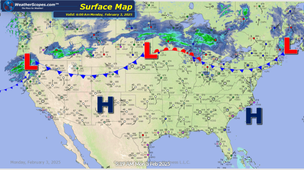
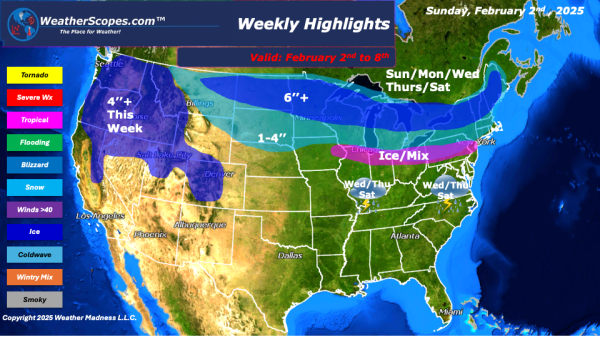
From the West to East a busy start to the work week. Rain and snow in the Pacific NW. Idaho, Oregon and Montana seeing snow today with accumulations of 1-4'' with higher amounts the higher in elevation. Snow in the Northern Plains with accumulations of a coating to 4''. A clipper coming through parts of... Continue Reading →
Weekly Highlights February 2nd to 8th
This week looks to be a messy one for many of us north of I-80. Multiple days this week we will deal with snow and clippers coming through the area bringing snow and ice. Sunday into Monday, a clipper will come through the Upper Great Lakes and into the Northeast. Then on Wednesday night into Thursday,... Continue Reading →
Daily Maps Sunday February 2nd, 2025
A clipper coming into the Upper Great Lakes into the Northeast today. Accumulations look to be around a coating to 3''. Another clipper will come through the area tomorrow morning and bring 4-6'' in the Upper Great Lakes, and the northern part of Maine. Some of the interior areas of the Northeast could see a... Continue Reading →
Daily Maps Saturday February 1st, 2025
Rain and snow still impacting the Pacific NW with snow in the Rockies. Rain and snow also in Northern California and the Sierra's. A clipper will come through the Upper Great Lakes and into parts of the Northeast later tonight and into tomorrow. Accumulations look to be around a coating to 3''. Parts of the... Continue Reading →
