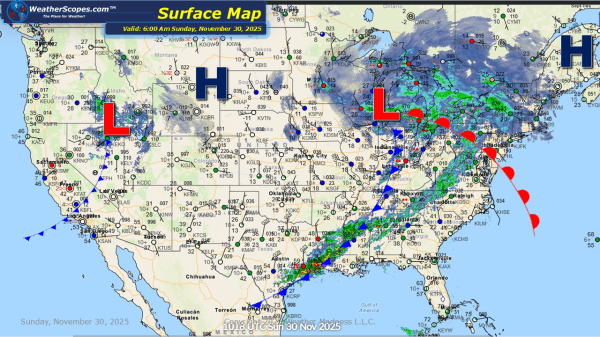
Today we will see some snow across the Plains into the Midwest and Great Lakes. Accumulations look to be 1-4’’. Tonight into tomorrow snow will move into the Northeast and some mixed precipitation to areas south of the snow, which could make for some dangerous conditions. The I-95 corridor looks to be where to the... Continue Reading →
Weekly Highlights November 30th to December 6th
As winter ramps up, this week’s forecast brings a mix of snow, cold, and even severe storms across large swaths of the U.S. — from the Rockies and Plains to the Midwest, Great Lakes, and Northeast.  On Sunday, snow arrives for the Northeast to kick off the week, with accumulations expected to reach 1–4″. Meanwhile, in... Continue Reading →
Daily Maps Sunday November 30th, 2025
This morning we will see some light snow move through the Upper Great Lakes and into the Northeast today, with accumulations of a coating to 4'' on the heavy side. Much of the Northern portion of the US still dealing with cold temps today and for the coming week. We will see some rain showers... Continue Reading →
Daily Maps Saturday November 29th, 2025
This morning we are already seeing snow across much of the Midwest and Great Lakes. This system will produce snow today and into Sunday. The heaviest snow will be centered in IL, IA, WI, and the western portion of Michigan and NW Indiana. Accumulations look to be around 7-14'' on the heavy side, and anywhere... Continue Reading →
