Daily Maps Wednesday December 17th, 2025

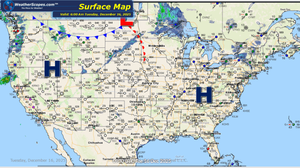
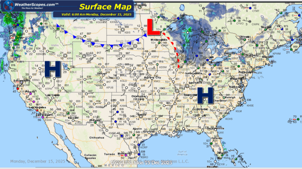
Today more showers and thunderstorms will impact Northern California into the Pac NW today producing some heavy rains and the potential for some localized flooding. Out across Eastern Texas into Louisiana some showers and thunderstorms today. Much of the central and eastern portion of the US is seeing some milder weather today. Temps are noticeably... Continue Reading →

Daily Maps Tuesday December 16th, 2025

Today we will see the Pac NW still dealing with showers and thunderstorms coming through the area, bringing the potential for some localized flooding. Over the next 48 hours much of the Plains into the eastern part of the US will see some milder temperatures. Most will see some 40 and 50 degree temperatures. Enjoy... Continue Reading →

Daily Maps Monday December 15th, 2025

This morning, we are seeing a clipper come through the Upper Great Lakes and will continue into the Northeast today, bringing snow and some lake-effect snows. Accumulations look to be around 1-4''. Areas around Watertown, NY could see accumulations over 4''. Showers and thunderstorms will move through the Pac NW today, creating the potential for... Continue Reading →

Weekly Highlights December 14th to 20th

This week’s weather pattern across the United States will show some notable temperature swings and several storm systems impacting different regions. Cold, brutal Arctic air will begin the week across the Plains, Midwest, Great Lakes, and Northeast. Temperatures in these areas will remain well below seasonal averages, reinforcing winter-like conditions and areas seeing single digit... Continue Reading →

Website Powered by WordPress.com.

Up ↑