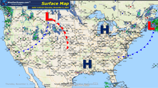
Today more showers and thunderstorms in the Pacific NW. Some scattered showers across parts of the Northeast as well as some cooler temps. There is a chance tomorrow for some severe weather to develop across the Tennessee Valley. Still watching some clipper snow to come into parts of the Plains, Midwest, and Northeast over the... Continue Reading →
Daily Maps Wednesday November 5th, 2025
Today the Pac NW and Northern California will see some showers and thunderstorms come into the area. More showers and thunderstorms are making their way across the Upper Great Lakes and into the Northeast later tonight, bringing some cooler temps and windy conditions. Some higher elevations in the Northeast could see a mix of some... Continue Reading →
Daily Maps Tuesday November 4th, 2025
Today the Pac NW will continue to see some showers throughout the day, and the Northern Rockies could see some snow in the higher elevations. The Northeast will see some cooler temps today after a cold front came on through yesterday bringing some showers and thunderstorms. Some of those storms in the New England area... Continue Reading →
Daily Maps Monday November 3rd, 2025
A cold front is advancing across the Midwest and Great Lakes region today, and it's expected to slide into the Northeast tonight. Ahead of the cold front, scattered showers will develop. As the front passes, cooler and drier air will filter in, bringing a noticeable drop in temperatures later this afternoon and into tonight. Meanwhile,... Continue Reading →
