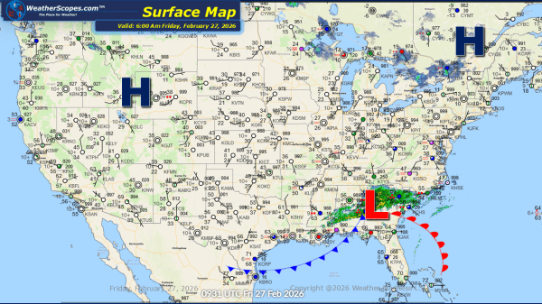
The Pacific Northwest continues to contend with periods of showers and isolated thunderstorms today, maintaining the risk for localized flooding in areas that have already seen several rounds of precipitation. Farther east, it’s another day and another fast-moving clipper sweeping through the Upper Great Lakes and progressing into the Northeast. North of the system, light... Continue Reading →
Daily Maps Tuesday December 9th, 2025
This morning we are seeing another clipper come through the Upper Great Lakes as it moves into the Northeast later today. Tonight yet another clipper will come through the Great Lakes and Northeast into tomorrow. Clipper snow will be the theme for the next 10 days or so with almost daily chances for snow to... Continue Reading →
Daily Maps Monday December 8th, 2025
This morning we are already seeing some mixed precipitation across Tennessee, Kentucky, the Virginia's and into North Carolina. The Virginia's, Kentucky, and Tennessee look to see some wet accumulating snow 1-4'', while areas along the Virginia/North Carolina border could see some snow and rain. Out in the Pac NW still dealing with some heavy rains... Continue Reading →
Daily Maps Sunday December 7th, 2025
A fast-moving Clipper swept across the Plains and Great Lakes overnight and into the early morning hours, dropping a quick 2–4 inches of snow for many locations. This system continues to move into the Northeast later today before exiting by tonight. While accumulations there will be lighter, slick travel is still possible during the afternoon... Continue Reading →
